
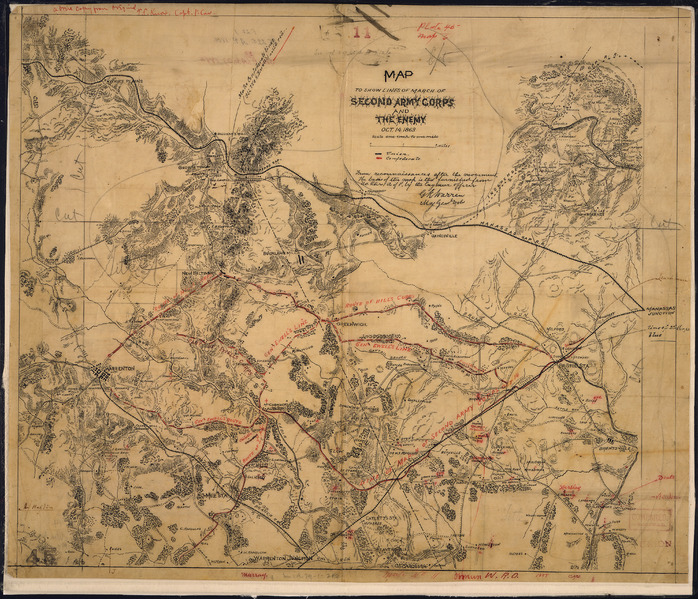
Image: Map to Show Lines of March of Second Army Corps and The Enemy, Oct. 14, 1863. (between Warrenton and Bristoe... - NARA - 305831
Size of this JPG preview of this TIF file: 698 × 599 pixels. Other resolution: 280 × 240 pixels.
Original image (4,000 × 3,435 pixels, file size: 39.31 MB, MIME type: image/tiff)
Title: Map to Show Lines of March of Second Army Corps and The Enemy, Oct. 14, 1863. [between Warrenton and Bristoe Station]...from reconnaissances after the movement...[signed] G. K. Warren, Maj. Genl., Vols.
Credit: U.S. National Archives and Records Administration
Author: Unknown or not provided
Usage Terms: Public domain
License: Public domain
Attribution Required?: No
Image usage
The following page links to this image:

All content from Kiddle encyclopedia articles (including the article images and facts) can be freely used under Attribution-ShareAlike license, unless stated otherwise.