
Image: Mapa-Territorio-Ifni-57-58

Size of this PNG preview of this SVG file: 424 × 600 pixels. Other resolution: 170 × 240 pixels.
Original image (SVG file, nominally 1,052 × 1,488 pixels, file size: 2.53 MB)
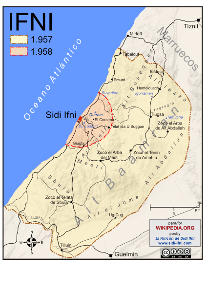
Description: Fronteras del territorio de Ifni antes y después de la Guerra de Ifni-Sáhara. Guerra que España libró con Marruecos desde noviembre de 1957 hasta junio de 1958.
Title: Mapa-Territorio-Ifni-57-58
Credit: Own work
Author: Pablovazram
Usage Terms: Creative Commons Attribution-Share Alike 4.0
License: CC BY-SA 4.0
License Link: https://creativecommons.org/licenses/by-sa/4.0
Attribution Required?: Yes
Image usage
The following page links to this image:

All content from Kiddle encyclopedia articles (including the article images and facts) can be freely used under Attribution-ShareAlike license, unless stated otherwise.