
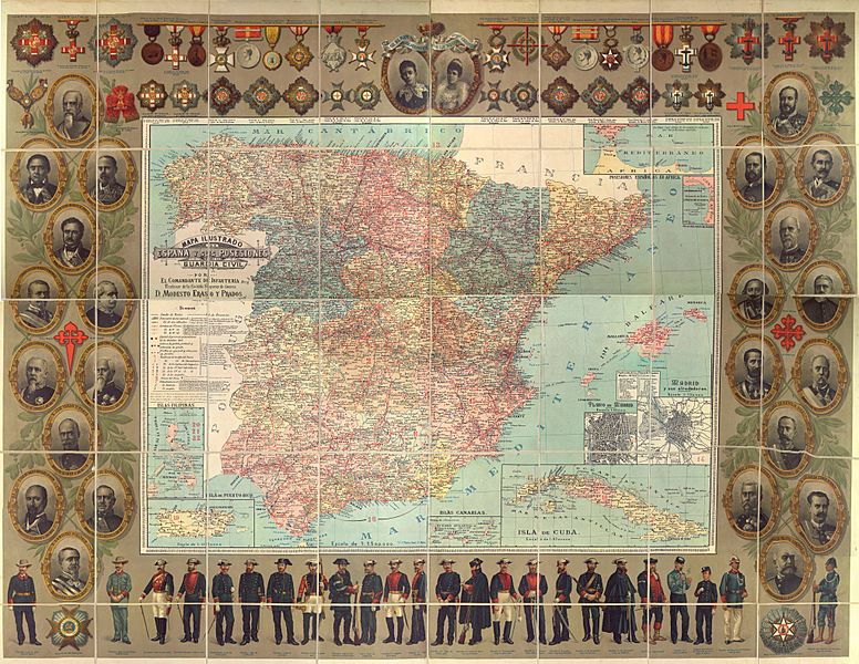
Image: Mapa ilustrado del Reino de España y sus posesiones para la Guardia Civil

Size of this preview: 776 × 600 pixels. Other resolutions: 311 × 240 pixels | 8,173 × 6,316 pixels.
Original image (8,173 × 6,316 pixels, file size: 38.66 MB, MIME type: image/jpeg)
Description: Illustrated map of the Kingdom of Spain and its remaining colonial posessions (Spanish Guinea, Spanish Sahara and Spanish Morocco not included) in 1895, prior to the Spanish-American War. This map was produced for the Guardia Civil (Gendarmerie of Spain) and so includes the portraits of the directors of the Guardia Civil. It also includes the different decorations available at the time.
Usage Terms: Public domain
Image usage
The following page links to this image:

All content from Kiddle encyclopedia articles (including the article images and facts) can be freely used under Attribution-ShareAlike license, unless stated otherwise.