
Image: Mapofiran1756
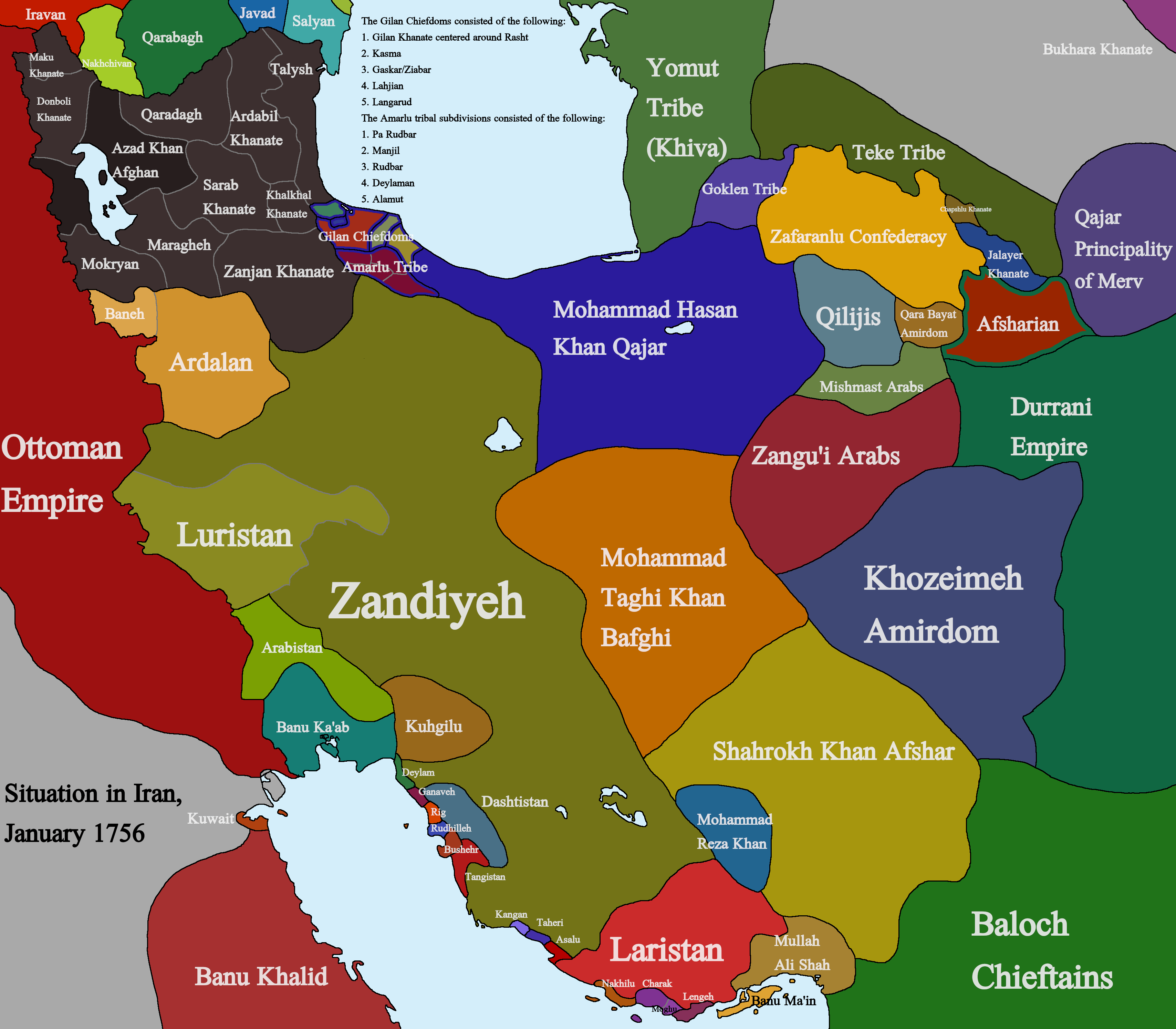
Description: A Map of Iran around January 1756, showing the situation during the post-Afsharid Era Sources used for the making of this map include: Karim Khan Zand by John Perry The Persian Gulf: The Rise of the Gulf Arabs, The Pollitics of Trade on the Persian Littoral 1747-1792 Various Encyclopedia Iranica Articles Travels Through Northern Persia 1770-1774 by Samuel Gottlieb Gmelin and Translated and Annotated by Willem Floor The Pearl In its' Midst: Herat and the Mapping of Khurasan (15th-19th Centuries) by Christine Noelle-Karimi an Azeri language book on the Maragheh Khanate Various books and articles by Yuri Bregel Willem Floor's article on the Banu Ka'ab Power struggles and trade in the Gulf 1620-1820 by al-Qasimi, Sultan bin Muhammad Willem Floor's book on the Hula Arabs Willem Floor's book on Lengeh Richard Tapper's book on the Shahsevan and various other maps and sources
Title: Mapofiran1756
Credit: Own work
Author: Kailanmapper
Usage Terms: Creative Commons Attribution-Share Alike 4.0
License: CC BY-SA 4.0
License Link: https://creativecommons.org/licenses/by-sa/4.0
Attribution Required?: Yes
Image usage
The following page links to this image:
