
Image: Marks Mills Battlefield Arkansas
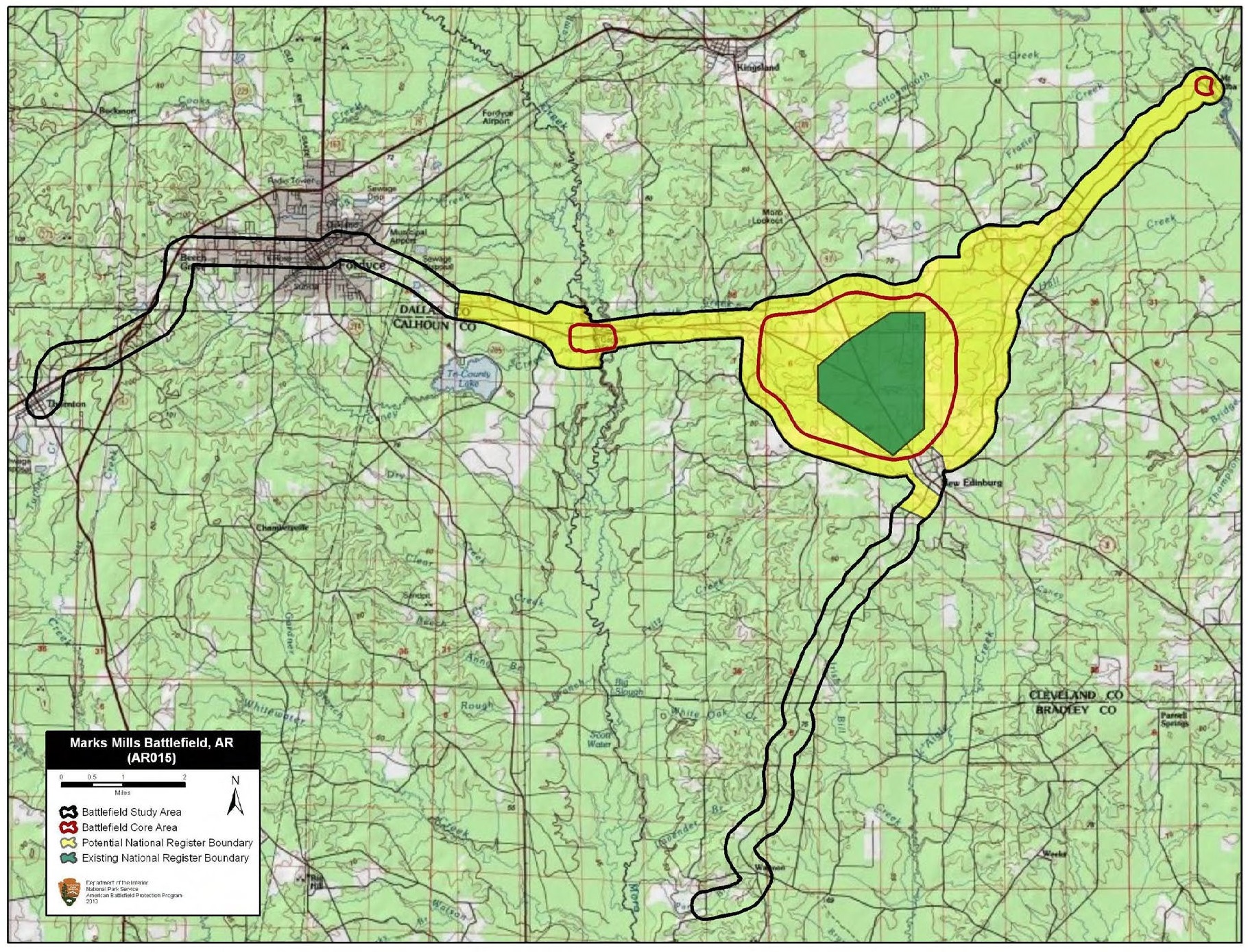
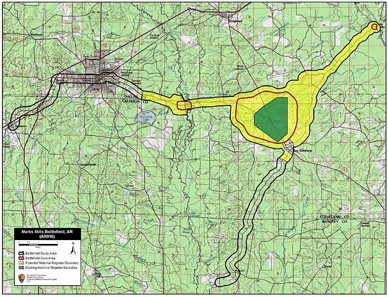
Description: Map of battlefield core and study areas. The 1993 Study Area boundary was a generic polygon that, while encompassing the battle, did not accurately reflect the battlefield. The ABPP significantly reduced the Study Area to more accurately reflect troop movements, areas of fighting, and historic road alignments. The ABPP has redrawn the Study Area to more accurately reflect BG Joseph O. Shelby's approach to the battlefield from the north and east, other approach and withdrawal routes, and troop movements. The 1993 Core Area was reshaped to more accurately reflect areas of fighting. In addition, two other Core Areas were added to the Study Area. The small easternmost Core Area represents the 1st Missouri Cavalry Battalion's capture of the Union held Saline River crossing at Mount Elba. The westernmost Core Area represents the fight at Moro Creek between the 1st Iowa Cavalry and Hunter's Missouri Cavalry Regiment. The Confederates failed in their attempt to capture the Federal horsemen at Moro Creek.
Title: Marks Mills Battlefield Arkansas
Credit: National Park Service
Author: American Battlefield Protection Program
Usage Terms: Public domain
License: Public domain
Attribution Required?: No
Image usage
The following page links to this image:
