
Image: Maryborough 1839 Ordnance Survey Map
No higher resolution available.
Maryborough_1839_Ordnance_Survey_Map.png (690 × 411 pixels, file size: 581 KB, MIME type: image/png)
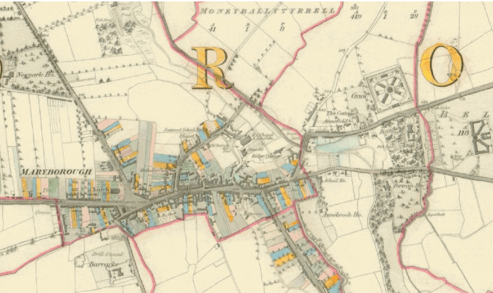
Description: Extract from the Ordnance Survey first edition 6” map, published 1839.
Title: Maryborough 1839 Ordnance Survey Map
Credit: Original publication: 1839 Immediate source: Ordnance Survey first edition 6” map, published 1839.
Author: Ordnance Survey (Life time: n/a)
Usage Terms: Public domain in the United States
License: PD-US
License Link: //en.wikipedia.org/wiki/File:Maryborough_1839_Ordnance_Survey_Map.png
Image usage
The following page links to this image:

All content from Kiddle encyclopedia articles (including the article images and facts) can be freely used under Attribution-ShareAlike license, unless stated otherwise.