
Image: Maskat & Oman map

Size of this preview: 567 × 599 pixels. Other resolutions: 227 × 240 pixels | 763 × 806 pixels.
Original image (763 × 806 pixels, file size: 10 KB, MIME type: image/png)
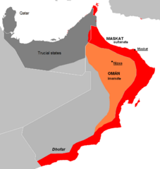
Description: The approximate map of historic state of Mascat and Oman.
Title: Maskat & Oman map
Credit: AT1306_map.png AT0801_map.png
Author: AT1306_map.png: Altatoron AT0801_map.png: Altatoron derivative work: Kolomaznik (talk)
Usage Terms: Public domain
License: Public domain
Attribution Required?: No
Image usage
The following 2 pages link to this image:

All content from Kiddle encyclopedia articles (including the article images and facts) can be freely used under Attribution-ShareAlike license, unless stated otherwise.