
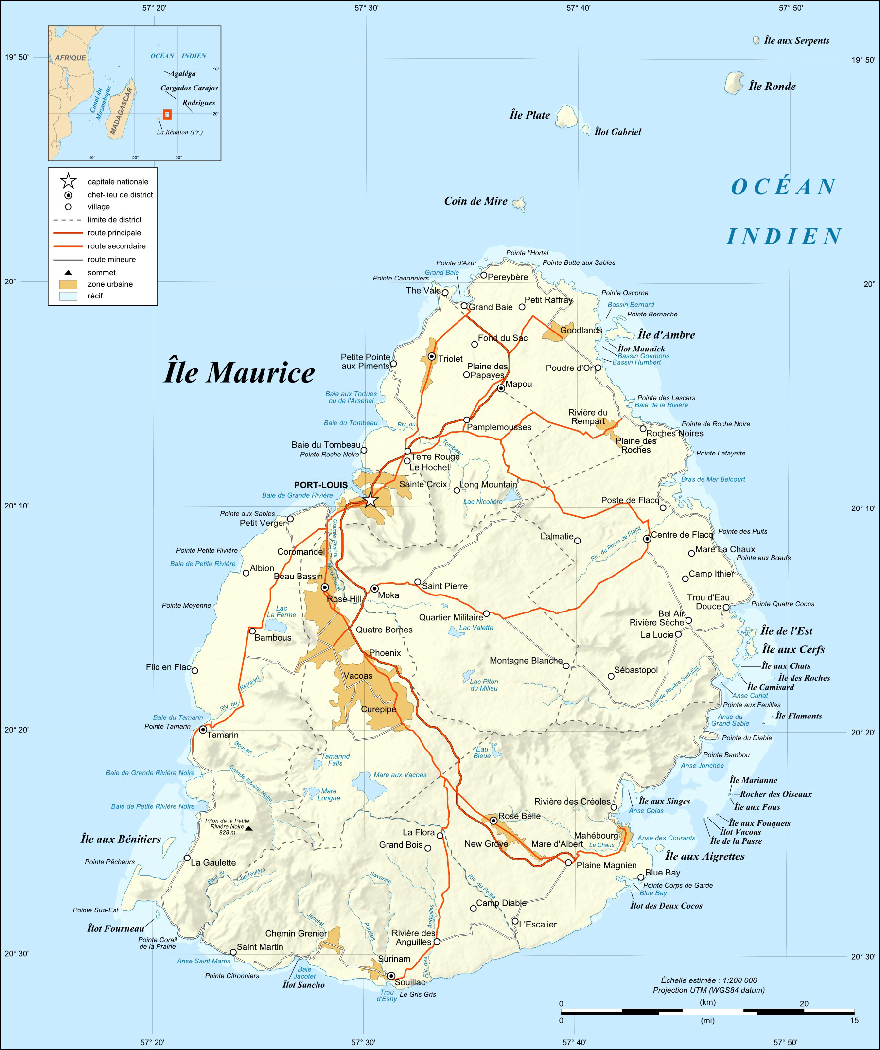
Image: Mauritius Island map-fr
Description: Map in French of Mauritius Island.
Title: Mauritius Island map-fr
Credit: Own work ; Shorelines : NASA Shuttle Radar Topography Mission (SRTM3 v.2) (public domain) ; Reef limits : created from Landsat ETM+ imagery (14.25 m resolution – public domain) ; Additional reference : Map of Mauritius' government.
Author: Eric Gaba (Sting - fr:Sting)
Permission: Attribution and Share-Alike required Any use of this map can be made as long as you credit me (Eric Gaba – Wikimedia Commons user: Sting) as the author and distribute the copies and derivative works under the same license(s) that the one(s) stated below. A message with a reply address would also be greatly appreciated.
Usage Terms: Creative Commons Attribution-Share Alike 4.0
License: CC BY-SA 4.0
License Link: https://creativecommons.org/licenses/by-sa/4.0
Attribution Required?: Yes
Image usage
The following page links to this image:
