
Image: Mawangdui Military Map

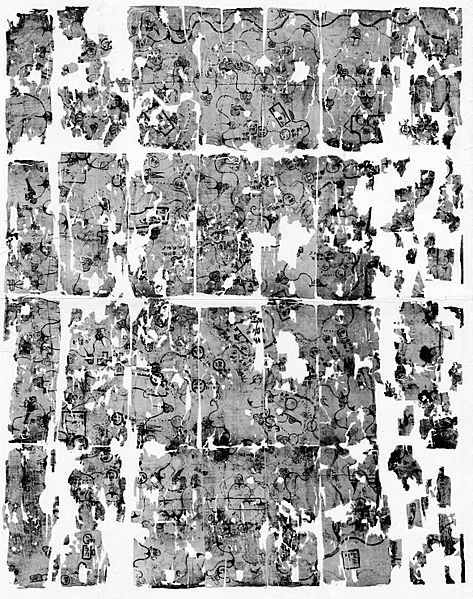
Description: Silk map showing military features in an area corresponding to most of the top left quarter of the Mawangdui Topographic Map. It marks the positions of Han military garrisons that were employed in an attack against Nanyue in 181 BC.[1] Found in 1973 in Tomb 3 of the Mawangdui Western Han tomb complex. Datable to circa 168 BC. Map was folded five times into 28 sections which later disintegrated along the folds into twenty-eight sheets. Dimensions: 98 × 78 cm. Scale: approximately 1:9,000. Oriented with south to the top.
Title: Mawangdui Military Map
Credit: Scanned from 《古地图(马王堆汉墓帛书)》 [Guditu (Mawangdui Hanmu Boshu)] (Beijing: Wenwu Chubanshe, 1977)
Author: Unknown authorUnknown author
Usage Terms: Public domain
License: Public domain
Attribution Required?: No
Image usage
The following page links to this image:
