
Image: Mazama bathymetry survey map
No higher resolution available.
Mazama_bathymetry_survey_map.jpg (600 × 345 pixels, file size: 61 KB, MIME type: image/jpeg)
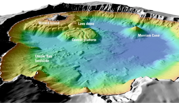
Description: USGS image from "Mount Mazama and Crater Lake: Growth and Destruction of a Cascade Volcano" Image caption at source: "Details of features beneath the surface of Crater Lake constructed using data from the 2000 bathymetry survey. Colors range from orange to blue with increasing water depth."
Title: Mazama bathymetry survey map
Usage Terms: Public domain
License: Public domain
Attribution Required?: No
Image usage
The following 2 pages link to this image:

All content from Kiddle encyclopedia articles (including the article images and facts) can be freely used under Attribution-ShareAlike license, unless stated otherwise.