
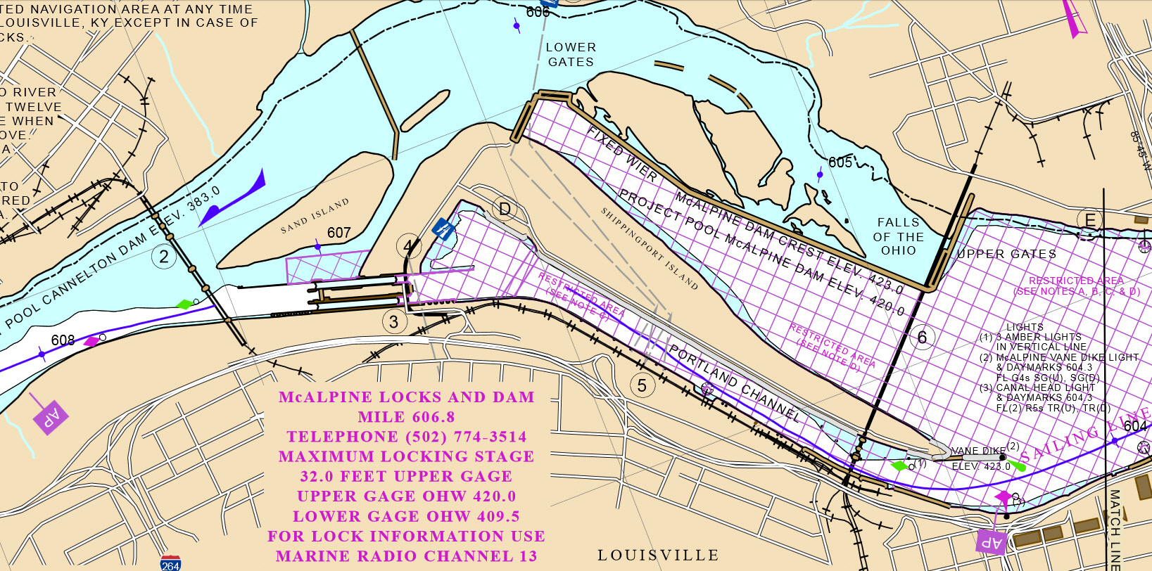
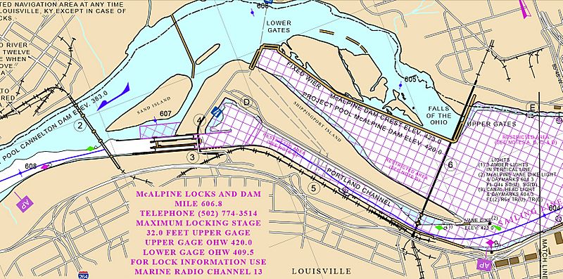
Image: McAlpine Locks and Dam navigation chart (detail) from 2010
Size of this preview: 800 × 397 pixels. Other resolutions: 320 × 159 pixels | 1,637 × 812 pixels.
Original image (1,637 × 812 pixels, file size: 866 KB, MIME type: image/jpeg)
Description: McAlpine Locks and Dam navigation chart (detail) Louisville, Kentucky
Title: McAlpine Locks and Dam navigation chart (detail) from 2010
Credit: Ohio River navigation chart no. 85 (detail)
Author: U.S. Army Corps of Engineers - Louisville District
Usage Terms: Public domain
License: Public domain
Attribution Required?: No
Image usage
The following page links to this image:

All content from Kiddle encyclopedia articles (including the article images and facts) can be freely used under Attribution-ShareAlike license, unless stated otherwise.
_from_2010.jpg)