
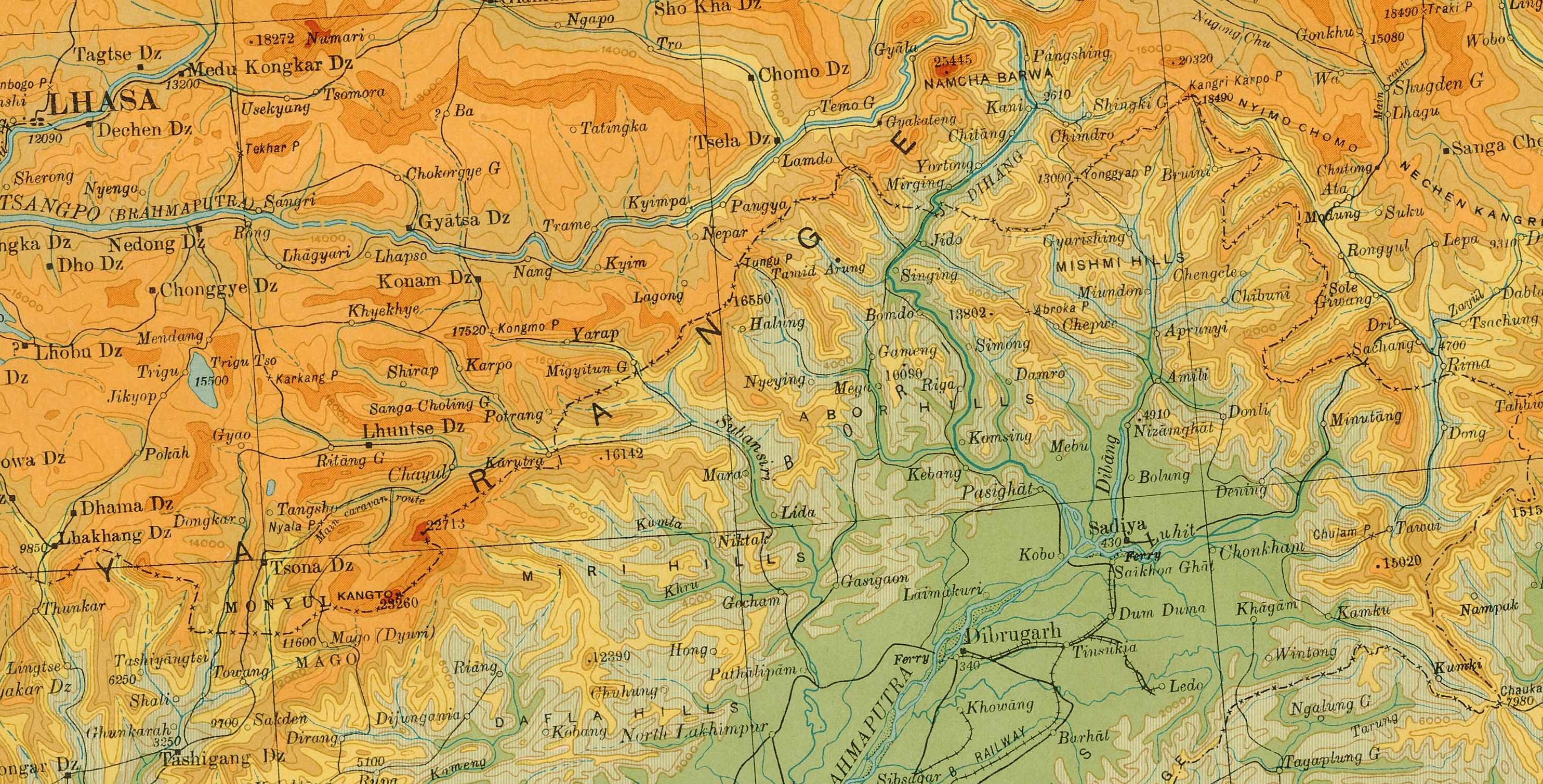
Image: McMahon Line on 1936 Survey of India map of Tibet
Size of this preview: 800 × 407 pixels. Other resolutions: 320 × 163 pixels | 2,969 × 1,509 pixels.
Original image (2,969 × 1,509 pixels, file size: 2.12 MB, MIME type: image/jpeg)
Description: McMahon Line depicted on 1936 map of Highlands of Tibet and Surrounding Regions by Survey of India
Title: McMahon Line on 1936 Survey of India map of Tibet
Credit: https://pahar.in/mountains/Maps--Primary/Tibet%20and%20China/Tibet%20and%20China--After%201900/1936%20Highlands%20of%20Tibet%20and%20Surrounding%20Regions%20by%20Survey%20of%20India.jpg
Author: Survey of India
Usage Terms: Public domain
License: Public domain
Attribution Required?: No
Image usage
The following page links to this image:

All content from Kiddle encyclopedia articles (including the article images and facts) can be freely used under Attribution-ShareAlike license, unless stated otherwise.