
Image: Medieval Arab Palestine
Size of this preview: 464 × 599 pixels. Other resolutions: 186 × 240 pixels | 824 × 1,064 pixels.
Original image (824 × 1,064 pixels, file size: 191 KB, MIME type: image/jpeg)
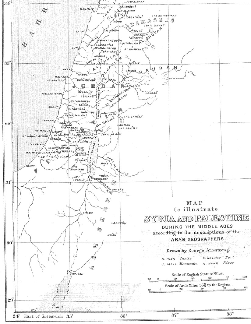
Description: Map of Palestine during the Middle Ages according to the description of the Arab geographers, drawn by Geo. Armstrong, from Palestine Under the Muslims: A Description of Syria and the Holy Land from AD 650 to 1500, by Guy Le Strange, London 1890
Title: Medieval Arab Palestine
Credit: Transferred from en.wikipedia to Commons.
Author: The original uploader was Mustafaa at English Wikipedia Later versions were uploaded by AnonMoos at en.wikipedia.
Usage Terms: Public domain
License: Public domain
Attribution Required?: No
Image usage
There are no pages that link to this image.

All content from Kiddle encyclopedia articles (including the article images and facts) can be freely used under Attribution-ShareAlike license, unless stated otherwise.