
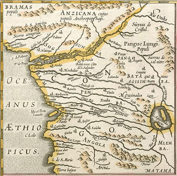
Image: Mercator Congo map

Size of this preview: 603 × 600 pixels. Other resolutions: 241 × 240 pixels | 879 × 874 pixels.
Original image (879 × 874 pixels, file size: 563 KB, MIME type: image/jpeg)
Description: 17th-century map of the Kingdom of Congo. This map was published as an inset labelled Congi regni in Africa Christiani nova descriptio. alongside a larger map Abissinorum sive Pretiosi Joannis imperium. It was published as an update to Mercator's Atlas sive cosmographicae meditationes de fabrica mundi et fabricati figura of 1595 (in spite of the filename, this is not a map made by Mercator himself!).
Title: Mercator Congo map
Credit: Northwestern University Library: African Maps
Author: published by Jodocus Hondius
Usage Terms: Public domain
License: Public domain
Attribution Required?: No
Image usage
The following page links to this image:

All content from Kiddle encyclopedia articles (including the article images and facts) can be freely used under Attribution-ShareAlike license, unless stated otherwise.