
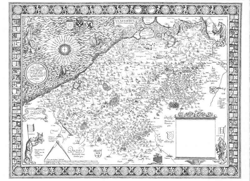
Image: Mercator map of Flanders 1539f
Size of this JPG preview of this TIF file: 800 × 582 pixels. Other resolution: 320 × 233 pixels.
Original image (13,655 × 9,939 pixels, file size: 2.85 MB, MIME type: image/tiff)
Description: Landkaart ingescand met een A0 scanner
Title: Mercator map of Flanders 1539
Credit: landkaart
Author: Gerardus Mercator
Usage Terms: Public domain
License: Public domain
Attribution Required?: No
Image usage
The following page links to this image:

All content from Kiddle encyclopedia articles (including the article images and facts) can be freely used under Attribution-ShareAlike license, unless stated otherwise.