
Image: Metropolitan Water District map (Boston, MA, 1910)
Size of this preview: 800 × 347 pixels. Other resolutions: 320 × 139 pixels | 2,571 × 1,115 pixels.
Original image (2,571 × 1,115 pixels, file size: 1.26 MB, MIME type: image/jpeg)
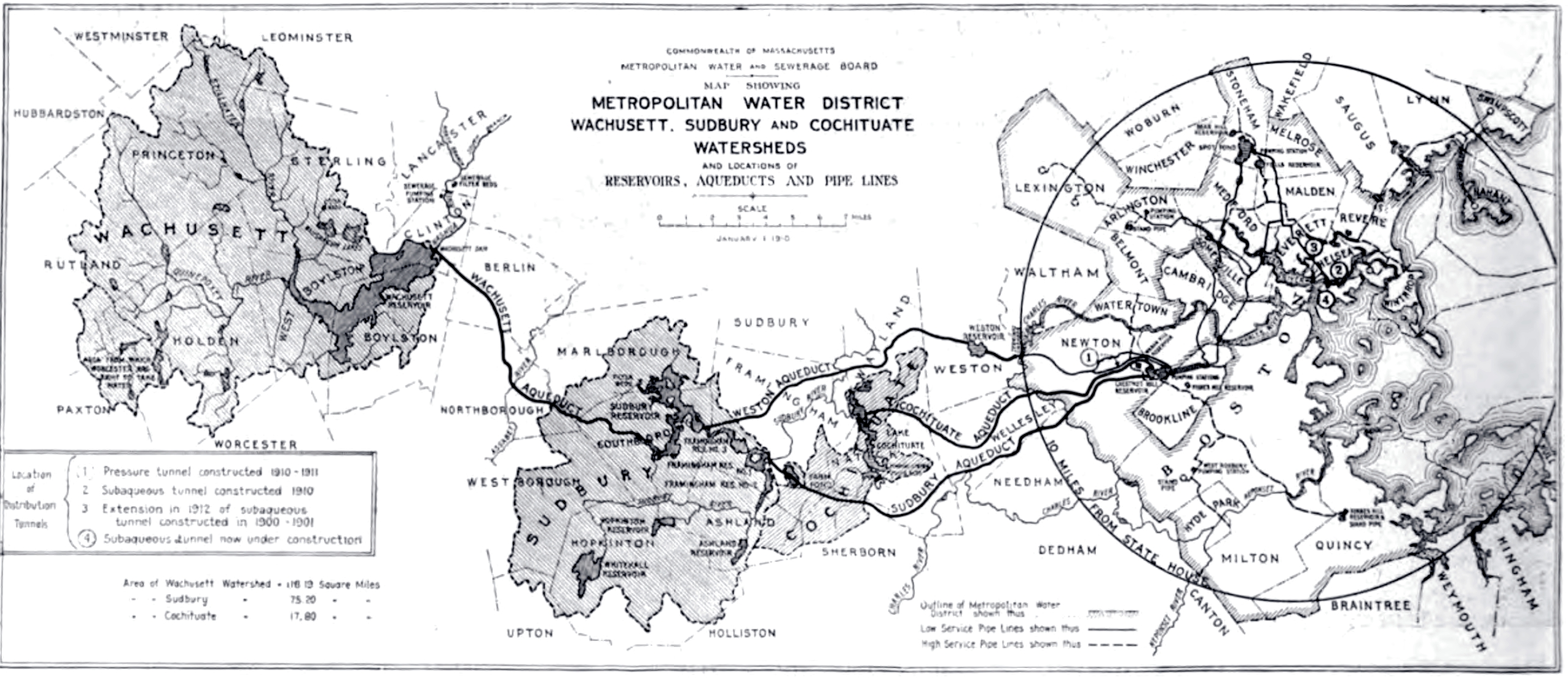
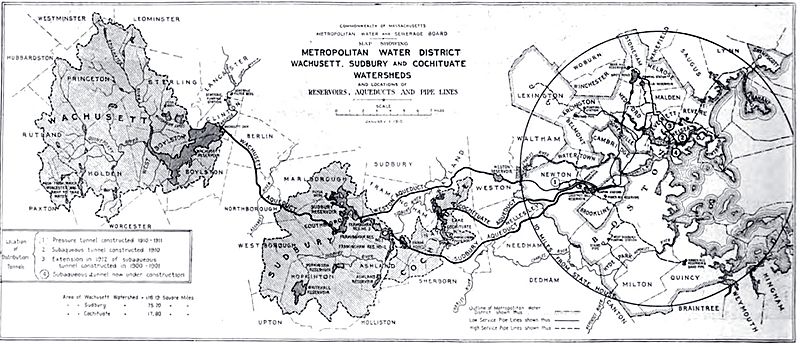
Description: 1910 map of the Metropolitan Water District system, Metropolitan Water & Sewage Board (Boston area), Commonwealth of Massachusetts, USA.
Title: Metropolitan Water District map (Boston, MA, 1910)
Credit: Halbert Powers Gillette, "Engineering & contracting", Vol. XLII, No. 4, Page 84.
Author: Metropolitan Water & Sewage Board, Commonwealth of Massachusetts.
Permission: Public domain - first published in the United States before 1923.
Usage Terms: Public domain
License: Public domain
Attribution Required?: No
Image usage
The following 4 pages link to this image:

All content from Kiddle encyclopedia articles (including the article images and facts) can be freely used under Attribution-ShareAlike license, unless stated otherwise.
.jpg)