
Image: Mexico Yucatan location map

Size of this PNG preview of this SVG file: 763 × 599 pixels. Other resolution: 306 × 240 pixels.
Original image (SVG file, nominally 2,815 × 2,211 pixels, file size: 1.01 MB)
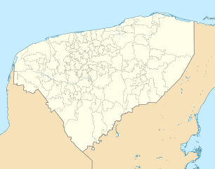
Description: Location Map of Yucatan EPSG:3857 projection, Geographic limits of the map: N: 21.80° N S: 19.30° N W: 90.60° W E: 87.20° W
Title: Mexico Yucatan location map
Credit: Sources of data: INEGI, Marco Geoestadístico Nacional, 2014. (Free use of the data)
Author: Addicted04 (talk)
Usage Terms: Public domain
License: Public domain
Attribution Required?: No
Image usage
The following 52 pages link to this image:
- Abalá, Yucatán
- Akil, Yucatán
- Baca, Yucatán
- Bokobá
- Buctzotz
- Cacalchén
- Calotmul
- Cansahcab
- Celestún
- Cenotillo
- Chacmultun
- Chichen Itza International Airport
- Chicxulub Pueblo
- Chunchucmil
- Cupul National Airport
- Dzoncauich
- Espita, Yucatán
- Hunucmá
- Kanasín
- Kancab
- Kaua, Yucatán
- Komchen
- Kulubá
- Maní, Yucatán
- Mayapan
- Motul, Yucatán
- Mérida, Yucatán
- Oxkutzcab
- Panabá
- Pisté, Yucatán
- Progreso, Yucatán
- Pustunich
- San José Chactún
- San José Tzal
- Sisal, Yucatán
- Teabo
- Tecoh
- Tekantó
- Tekax
- Temax
- Temozón
- Ticul
- Tixkokob
- Tizimín
- Tunkás
- Tzucacab
- Ucí
- Umán
- X'box (Yucatán)
- X-Can
- Yobaín
- Yotholín

All content from Kiddle encyclopedia articles (including the article images and facts) can be freely used under Attribution-ShareAlike license, unless stated otherwise.