
Image: Middlesex Canal (Massachusetts) map, 1801
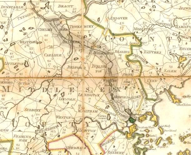
Description: Map of the Middlesex Canal, Middlesex County, Massachusetts, 1801. This map was published about 1 year before the canal opened for boat traffic.
Title: Middlesex Canal (Massachusetts) map, 1801
Credit: "Map of Massachusetts", Osgood Carleton, engraved by Joseph Callendar and Samuel Hill, published 1801. This scan is from the David Rumsey Map Collection, and has been cropped to remove extraneous terrain and digitally enhanced to emphasize the canal's route.
Author: Osgood Carleton.
Permission: The following text is taken from the David Rumsey web site: Images copyright © 2000 by Cartography Associates. Images may be reproduced or transmitted, but not for commercial use. For commercial use or commercial republication, contact carto@luna-img.com. This work is licensed under a Creative Commons License.
Usage Terms: Public domain
License: Public domain
Attribution Required?: No
Image usage
The following 2 pages link to this image:

_map,_1801.jpg)