
Image: Milton Village map - geograph.org.uk - 823107

Size of this preview: 600 × 600 pixels. Other resolutions: 240 × 240 pixels | 640 × 640 pixels.
Original image (640 × 640 pixels, file size: 140 KB, MIME type: image/jpeg)
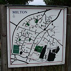
Description: Milton Village map This map, at the southern end of the High Street, shows the wave of new housing estate building which has occurred within the sweeping line of the bypass at the top and left since it was built in 1978.
Title: Milton Village map - geograph.org.uk - 823107
Credit: From geograph.org.uk
Author: Keith Edkins
Usage Terms: Creative Commons Attribution-Share Alike 2.0
License: CC BY-SA 2.0
License Link: http://creativecommons.org/licenses/by-sa/2.0
Attribution Required?: Yes
Image usage
The following page links to this image:

All content from Kiddle encyclopedia articles (including the article images and facts) can be freely used under Attribution-ShareAlike license, unless stated otherwise.