
Image: MilwaukeeStreetMapShowingBridgesAtAngles

Size of this preview: 800 × 578 pixels. Other resolutions: 320 × 231 pixels | 1,140 × 824 pixels.
Original image (1,140 × 824 pixels, file size: 310 KB, MIME type: image/png)
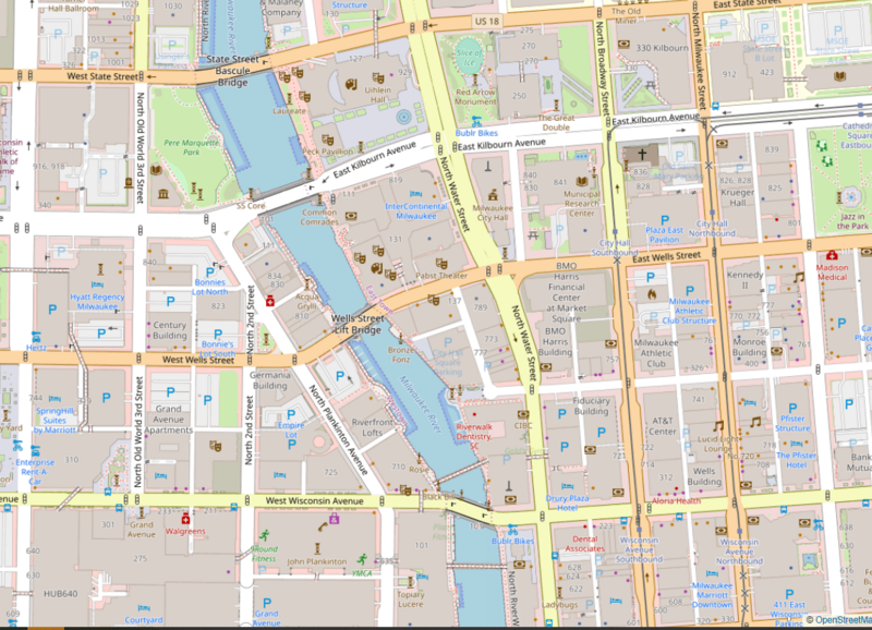
Description: Open Street Map view of Milwaukee showing the Milwaukee river highlighting the difference in grid layouts between the east and west side and the unusual angle of the bridges
Title: MilwaukeeStreetMapShowingBridgesAtAngles
Credit: https://www.openstreetmap.org/search?query=Juneautown%20#map=15/43.0419/-87.9001
Author: OpenStreetMap
Usage Terms: Creative Commons Attribution-Share Alike 2.0
License: CC BY-SA 2.0
License Link: https://creativecommons.org/licenses/by-sa/2.0
Attribution Required?: Yes
Image usage
The following page links to this image:

All content from Kiddle encyclopedia articles (including the article images and facts) can be freely used under Attribution-ShareAlike license, unless stated otherwise.