
Image: Mississippi Delta IR
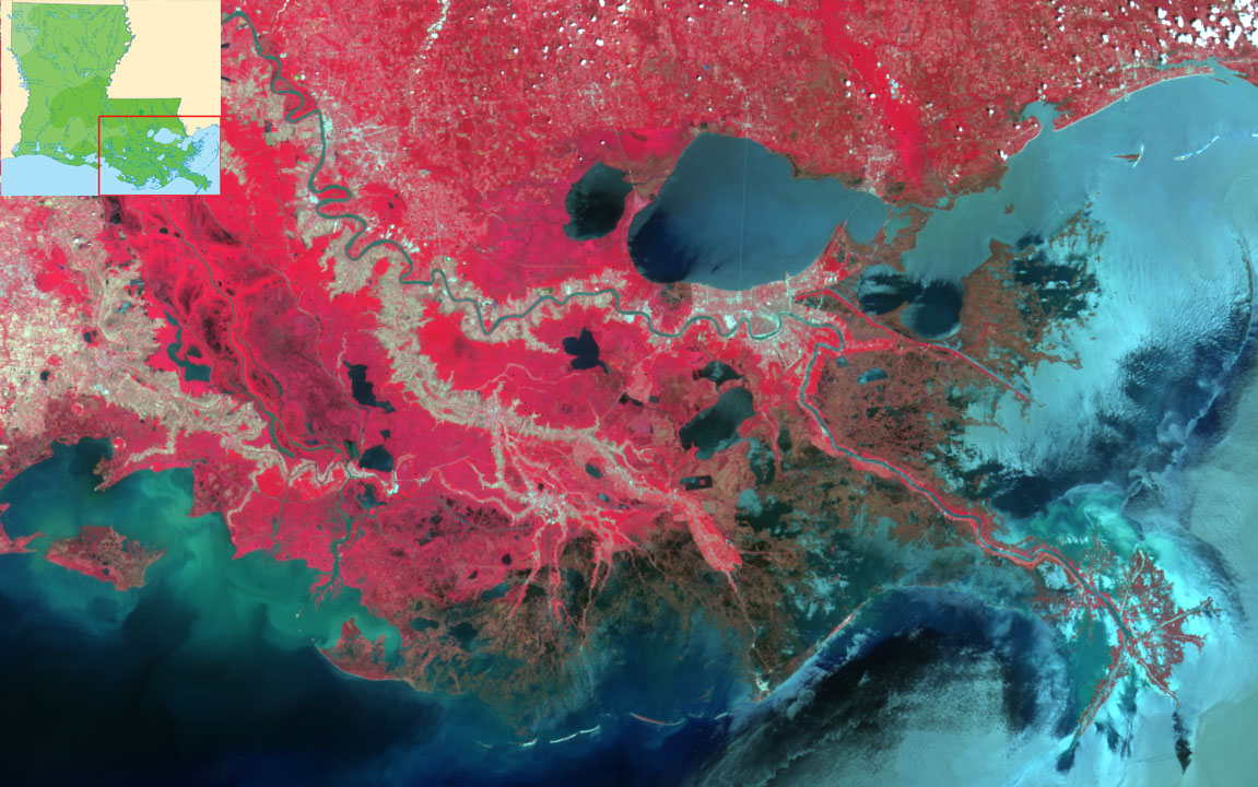
Description: Mississippi River Delta. False-color photograph with vegetation in red. Inset showing relative position to Louisiana state. Original Description These Multi-angle Imaging SpectroRadiometer (MISR) images of the Mississippi delta were acquired on April 26, 2000. The true color image displays the alluvial fan of the Mississippi delta where the river flows into the Gulf of Mexico. New Orleans is visible on the south bank of Lake Ponchartrain. The four-lane, 24-mile Lake Ponchartrain Causeway, the longest over-water bridge in the world, is discernible across the middle of Lake Ponchartrain. A smaller bridge that crosses to Slidell is visible at the east end of the lake. The city upstream is Baton Rouge. Farther upstream are several oxbow lakes. As a river ages, it begins to meander when the current erodes outer edges and redeposits the resulting silt. Sometimes the river straightens and cuts off the meander loop, forming an oxbow lake. The false color image uses the infrared, red, and green spectral bands to display areas of vegetation in red. The oxbow lakes are particularly visible in this image. image source: http://eosweb.larc.nasa.gov/HPDOCS/misr/misr_html/miss_delta_2views.html inset source: http://nationalatlas.gov/printable/images/pdf/precip/pageprecip_la3.pdf Source page credits the image to the Atmospheric Sciences Data Center at NASA's Langley Research Center.
Title: Mississippi Delta IR
Credit: Transferred from en.wikipedia to Commons.
Author: The original uploader was Interiot at English Wikipedia.
Permission: PD-USGOV-NASA.
Usage Terms: Public domain
License: Public domain
Attribution Required?: No
Image usage
The following page links to this image:
