
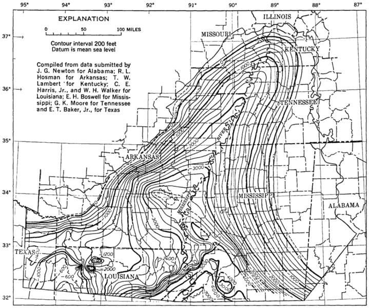
Image: Mississippi Embayment Top Cretaceous Contour Map

Size of this preview: 719 × 600 pixels. Other resolutions: 288 × 240 pixels | 1,199 × 1,000 pixels.
Original image (1,199 × 1,000 pixels, file size: 773 KB, MIME type: image/png)
Description: Mississippi Embayment Top Cretaceous Contour Map
Title: Mississippi Embayment Top Cretaceous Contour Map
Credit: General Geology of the Mississippi Embayment, USGS Professional Paper 448-B
Author: E. M. GUSHING, E. H. BOSWELL, and R. L. HOSMAN
Usage Terms: Public domain
License: Public domain
Attribution Required?: No
Image usage
The following page links to this image:

All content from Kiddle encyclopedia articles (including the article images and facts) can be freely used under Attribution-ShareAlike license, unless stated otherwise.