
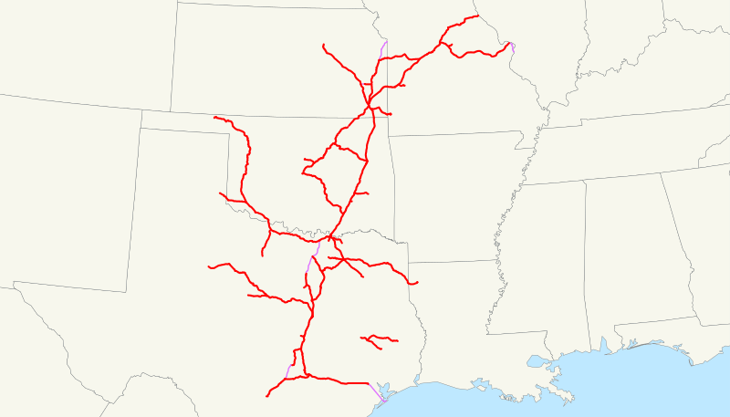
Image: Missouri, Kansas and Texas Railway system map (1918)

Size of this PNG preview of this SVG file: 800 × 457 pixels. Other resolution: 320 × 183 pixels.
Original image (SVG file, nominally 1,120 × 640 pixels, file size: 328 KB)
Description: This is a map of the Missouri, Kansas and Texas Railway (Katy) as of 1918, with trackage rights in purple and then-proposed lines dotted. Email me if you would like a copy of the GIS data I created (modified from Bureau of Transportation Statistics North American Transportation Atlas Data) or if you see any errors.
Title: Missouri, Kansas and Texas Railway system map (1918)
Credit: No machine-readable source provided. Own work assumed (based on copyright claims).
Author: No machine-readable author provided. NE2 assumed (based on copyright claims).
Usage Terms: Public domain
License: Public domain
Attribution Required?: No
Image usage
The following page links to this image:

All content from Kiddle encyclopedia articles (including the article images and facts) can be freely used under Attribution-ShareAlike license, unless stated otherwise.
.svg)