
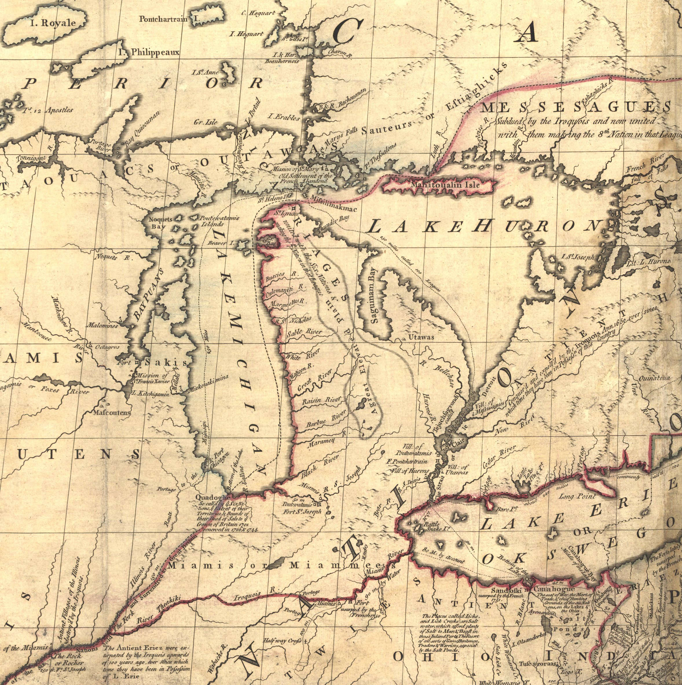
Image: Mitchell map michigan
Size of this preview: 597 × 600 pixels. Other resolutions: 239 × 240 pixels | 2,356 × 2,366 pixels.
Original image (2,356 × 2,366 pixels, file size: 5.97 MB, MIME type: image/jpeg)
Description: Mitchell Map - A map of the British and French dominions in North America,...; 1757, cropped to Michigan region
Title: Mitchell map michigan
Credit: Library of Congress
Author: John Mitchell; digital version, Library of Congress, Geography and Map Division.
Permission: "The Library of Congress is providing access to these materials for educational and research purposes and is not aware of any U.S. copyright protection" (source: http://memory.loc.gov/cgi-bin/ammemrr.pl?title=Map%20Collections&coll=gmd&div=&agg=g3300&default=ammem&dir=ammem)
Usage Terms: Public domain
License: Public domain
Attribution Required?: No
Image usage
The following page links to this image:

All content from Kiddle encyclopedia articles (including the article images and facts) can be freely used under Attribution-ShareAlike license, unless stated otherwise.