
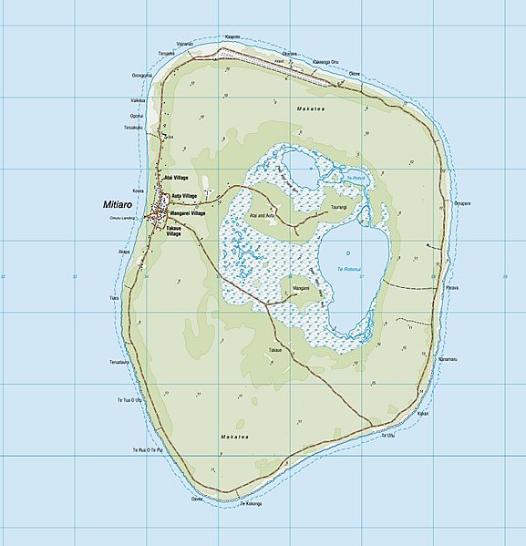
Image: Mitiaro Island topo map 2014 (cropped)

Size of this preview: 577 × 599 pixels. Other resolutions: 231 × 240 pixels | 3,461 × 3,593 pixels.
Original image (3,461 × 3,593 pixels, file size: 2.08 MB, MIME type: image/jpeg)
Description: topographic map of Mitiaro Island, southern Cook Islands, South Pacific Ocean
Title: Mitiaro Island topo map 2014 (cropped)
Credit: https://www.linz.govt.nz/land/maps/pacific-region-maps
Author: Land Information New Zealand
Usage Terms: Creative Commons Attribution 4.0
License: CC BY 4.0
License Link: https://creativecommons.org/licenses/by/4.0
Attribution Required?: Yes
Image usage
The following page links to this image:

All content from Kiddle encyclopedia articles (including the article images and facts) can be freely used under Attribution-ShareAlike license, unless stated otherwise.
.jpg)