
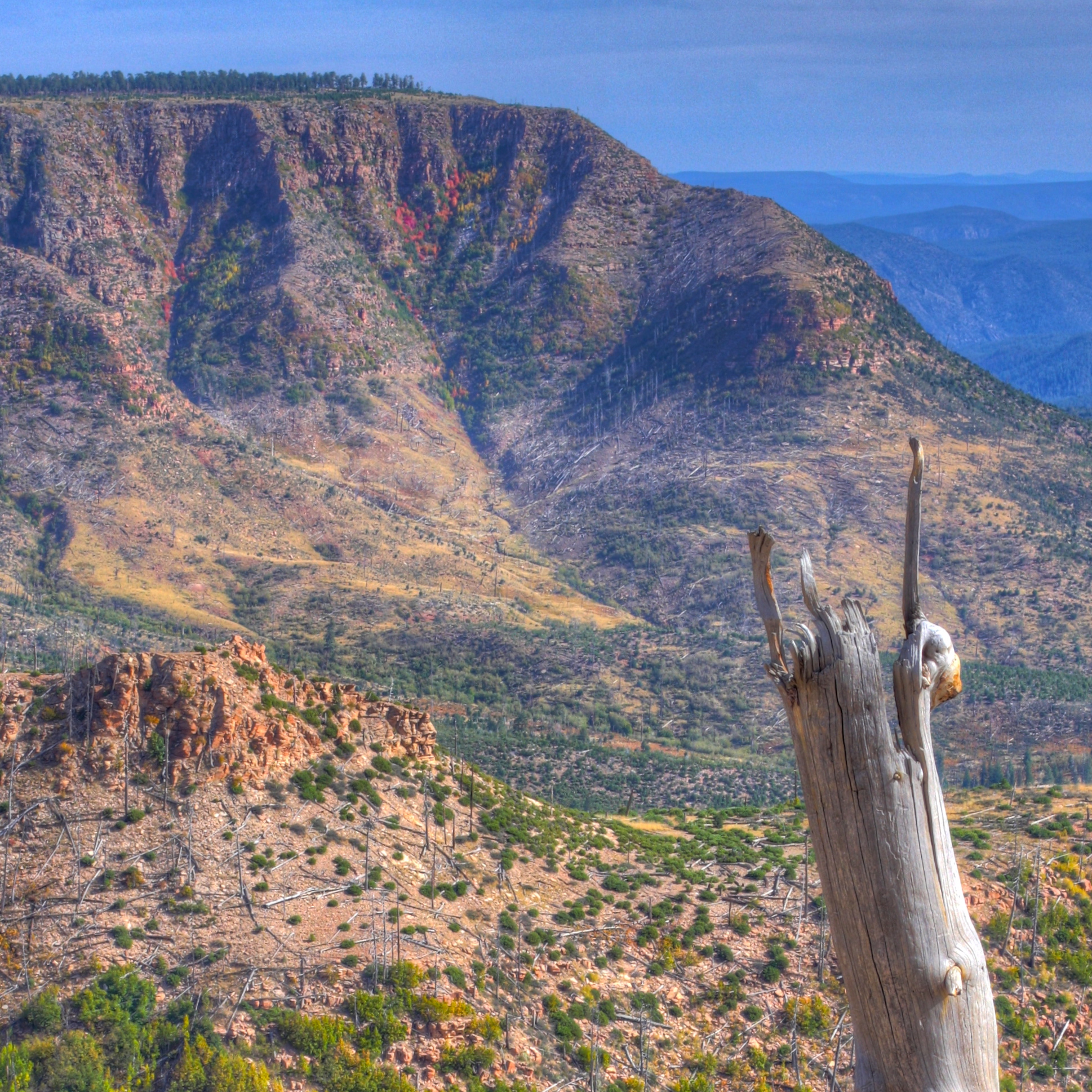
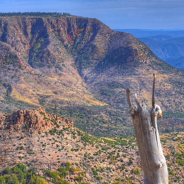
Image: Mogollon Rim east of Pine
Size of this preview: 600 × 600 pixels. Other resolutions: 240 × 240 pixels | 1,938 × 1,938 pixels.
Original image (1,938 × 1,938 pixels, file size: 1.89 MB, MIME type: image/jpeg)
Description: The Mogollon Rim — east of Pine, in Gila County, Arizona. The Mogollon Rim stretches 320 kilometres (200 mi) from the middle of Arizona to the New Mexico border. Along much of the Rim the elevation ranges from 1,500 metres (4,900 ft) to 2,100 metres (6,900 ft). One can see that much of the tree growth is dead, either from a planned or unplanned burn. (Explore)... View Large On Black
Title: Mogollon Rim east of Pine
Credit: Mogollon Rim Uploaded by PDTillman
Author: Kevin Dooley from Chander, AZ, USA
Usage Terms: Creative Commons Attribution 2.0
License: CC BY 2.0
License Link: http://creativecommons.org/licenses/by/2.0
Attribution Required?: Yes
Image usage
The following 3 pages link to this image:

All content from Kiddle encyclopedia articles (including the article images and facts) can be freely used under Attribution-ShareAlike license, unless stated otherwise.