
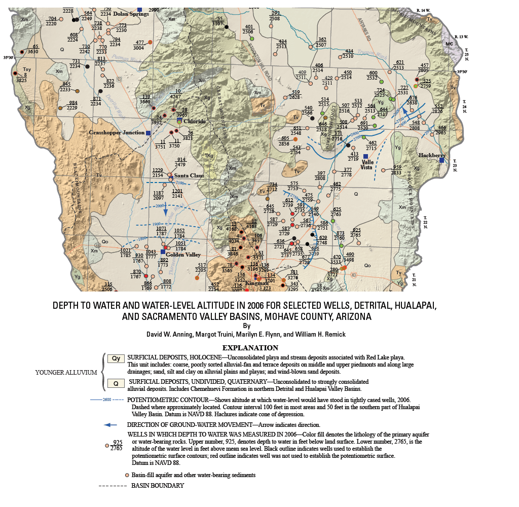
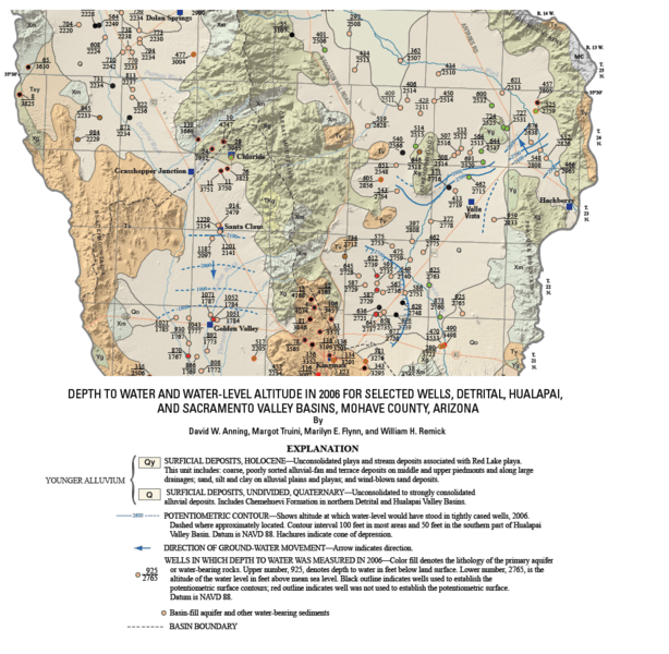
Image: MohaveCountyWaterDepth2006
Size of this preview: 614 × 600 pixels. Other resolutions: 246 × 240 pixels | 1,024 × 1,000 pixels.
Original image (1,024 × 1,000 pixels, file size: 735 KB, MIME type: image/png)
Description: 2006 United States Geological Survey survey of the depth to water and water-level altitude in Arizona for selected wells.
Title: MohaveCountyWaterDepth2006
Credit: Anning, David W. (2007). Depth to water and water-level altitude in 2006 for selected wells, Detrital, Hualapai, and Sacramento Valley Basins, Mohave County, Arizona—Plate 1 (PDF) (Map). 1:100,000. United States Geological Survey. Retrieved 2008-12-22.
Author: David W. Anning as modified by -- Suntag ☼
Permission: Template:PD-USGov-USGS
Usage Terms: Public domain
License: PD
Attribution Required?: No
Image usage
The following 2 pages link to this image:

All content from Kiddle encyclopedia articles (including the article images and facts) can be freely used under Attribution-ShareAlike license, unless stated otherwise.