
Image: MongolEmpireDivisions1300

Size of this preview: 800 × 467 pixels. Other resolutions: 320 × 187 pixels | 1,644 × 959 pixels.
Original image (1,644 × 959 pixels, file size: 48 KB, MIME type: image/png)
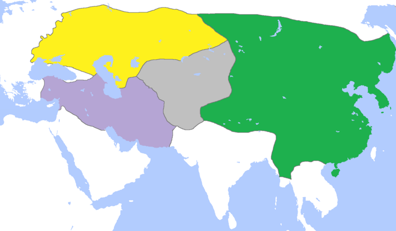
Description: Map of the Mongol Empire c. 1300, after its four subdivisions into the: Golden Horde (yellow) Chagatai Khanate (gray) Great Yuan−Yuan Dynasty (green) Ilkhanate (purple). Credits (Partially based on Atlas of World History (2007) - The World 1200-1300, map)
Title: MongolEmpireDivisions1300
Credit: Own work
Author: Gabagool
Usage Terms: Creative Commons Attribution 3.0
License: CC BY 3.0
License Link: http://creativecommons.org/licenses/by/3.0
Attribution Required?: Yes
Image usage
The following 2 pages link to this image:

All content from Kiddle encyclopedia articles (including the article images and facts) can be freely used under Attribution-ShareAlike license, unless stated otherwise.