
Image: MoonTopoLOLA
No higher resolution available.
MoonTopoLOLA.png (800 × 551 pixels, file size: 697 KB, MIME type: image/png)
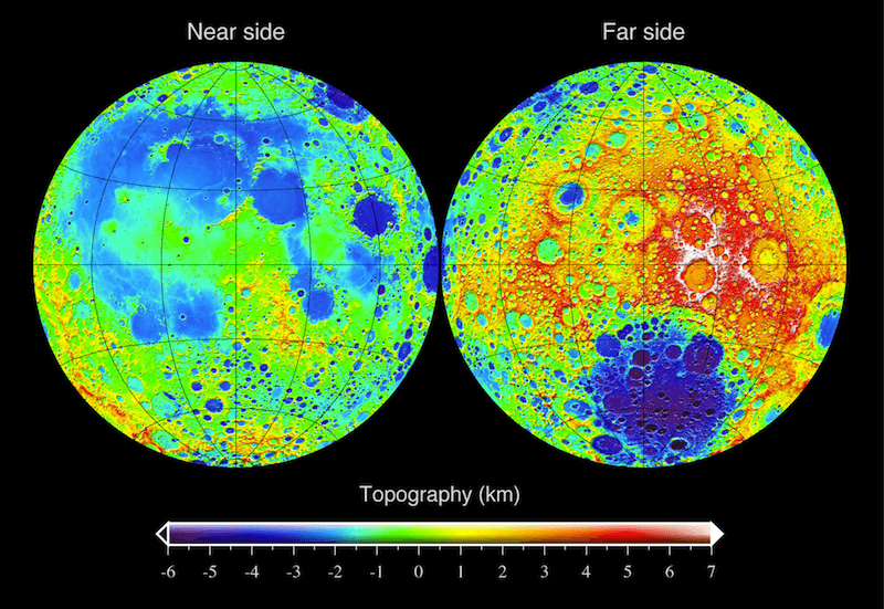
Description: The topography of the Moon referenced to a sphere with a radius of 1737.4 kilometers. Data were obtained from the Lunar Orbiter Laser Altimeter (LOLA) that was flown on the mission Lunar Reconnaissance Orbiter (LRO). The color coded topography is displayed in two Lambert equal area images projected on the near and far side hemispheres.
Title: MoonTopoLOLA
Credit: Own work
Author: Mark A. Wieczorek
Usage Terms: Creative Commons Attribution 3.0
License: CC BY 3.0
License Link: http://creativecommons.org/licenses/by/3.0
Attribution Required?: Yes
Image usage
The following 2 pages link to this image:

All content from Kiddle encyclopedia articles (including the article images and facts) can be freely used under Attribution-ShareAlike license, unless stated otherwise.