
Image: Moorland with view of Foel Cwmcerwyn - geograph.org.uk - 1447660
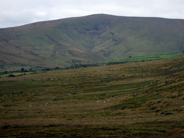
Description: Moorland with view of Foel Cwmcerwyn From the flank of Carn Sian there is a fine view of Mynydd Preseli's highest peak, Foel Cwmcerwyn, at 536 m/1759 ft. The name, Hill of the Tub Valley, must come from the shape of the great scoop visible here below the summit. This was in fact the locus of the only self-generated glacial icefield in this area, as opposed to the giant Irish Sea icesheet that moved across the land from the west. Also visible are the remains of an attempt to quarry slate on the mountain but the effort of transporting the stone around to Rosebush on the other side must have defeated the effort.
Title: Moorland with view of Foel Cwmcerwyn - geograph.org.uk - 1447660
Credit: From geograph.org.uk
Author: ceridwen
Usage Terms: Creative Commons Attribution-Share Alike 2.0
License: CC BY-SA 2.0
License Link: https://creativecommons.org/licenses/by-sa/2.0
Attribution Required?: Yes
Image usage
The following page links to this image:
