
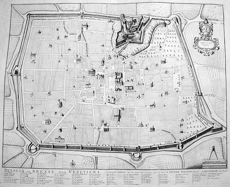
Image: Mortier, Pierre (1661-1711), Mappa di Brescia a inizio Settecento

Size of this preview: 735 × 599 pixels. Other resolutions: 294 × 240 pixels | 1,402 × 1,143 pixels.
Original image (1,402 × 1,143 pixels, file size: 1,008 KB, MIME type: image/jpeg)
Description: Pierre Mortier (1661-1711), engraving showing the map of Brescia at the end of 17th century or at beginning of 18th. Picture by: Giovanni Dall'Orto, 21-7-2006.
Title: Mortier, Pierre (1661-1711), Mappa di Brescia a inizio Settecento
Credit: Own work
Author: G.dallorto
Usage Terms: Creative Commons Attribution-Share Alike 2.5
License: CC BY-SA 2.5
License Link: http://creativecommons.org/licenses/by-sa/2.5
Attribution Required?: Yes
Image usage
The following page links to this image:

All content from Kiddle encyclopedia articles (including the article images and facts) can be freely used under Attribution-ShareAlike license, unless stated otherwise.
,_Mappa_di_Brescia_a_inizio_Settecento.jpg)