
Image: NCH collapse map
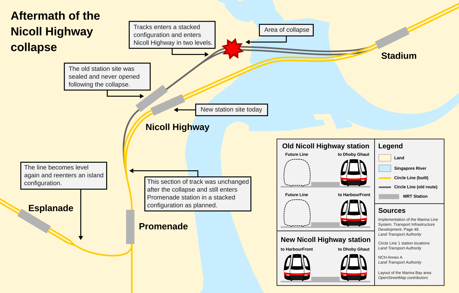
Description: Map depicts the original and built track configuration of the Circle Line following the Nicoll Highway collapse
Title: NCH collapse map
Credit: Marina Bay layout and current track configuration was taken from OpenStreetMap contributors. Old track layout based on old maps by the Land Transport Authority. (CCL Stage 1 map and Realigned map) Platform configuration data was taken from "Implementation of the Marina Line System". Singapore : Transporation Infrastructure Development. p. 48. Depiction of platform configuration of the old and new Nicoll Highway stations is drawn from scratch by me.
Author: Seloloving
Usage Terms: Creative Commons Attribution-Share Alike 2.0
License: CC BY-SA 2.0
License Link: https://creativecommons.org/licenses/by-sa/2.0
Attribution Required?: Yes
Image usage
The following page links to this image:
