
Image: NCyprus districts named
No higher resolution available.
NCyprus_districts_named.png (600 × 365 pixels, file size: 47 KB, MIME type: image/png)
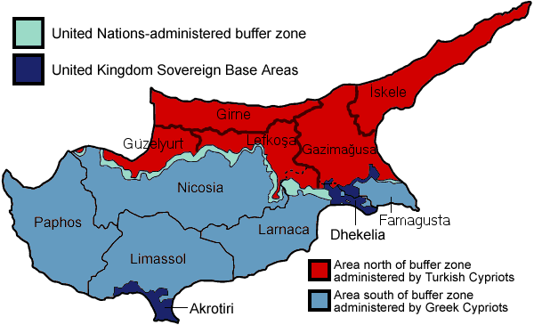
Description: Map of the districts of Cyprus, with English annotations, and showing the Turkish Republic of Northern Cyprus, United Kingdom Sovereign Base Areas, and United Nations buffer zone. The TRNC section illustrates the current de facto district boundaries following this map as a guide. The northern districts are labelled in Turkish.
Title: NCyprus districts named
Credit: Cyprus_districts_named.png
Author: derivative work: QuartierLatin1968 (talk) Cyprus_districts_named.png: User:Golbez
Usage Terms: Creative Commons Attribution-Share Alike 3.0
License: CC-BY-SA-3.0
License Link: http://creativecommons.org/licenses/by-sa/3.0/
Attribution Required?: Yes
Image usage
The following 2 pages link to this image:

All content from Kiddle encyclopedia articles (including the article images and facts) can be freely used under Attribution-ShareAlike license, unless stated otherwise.