
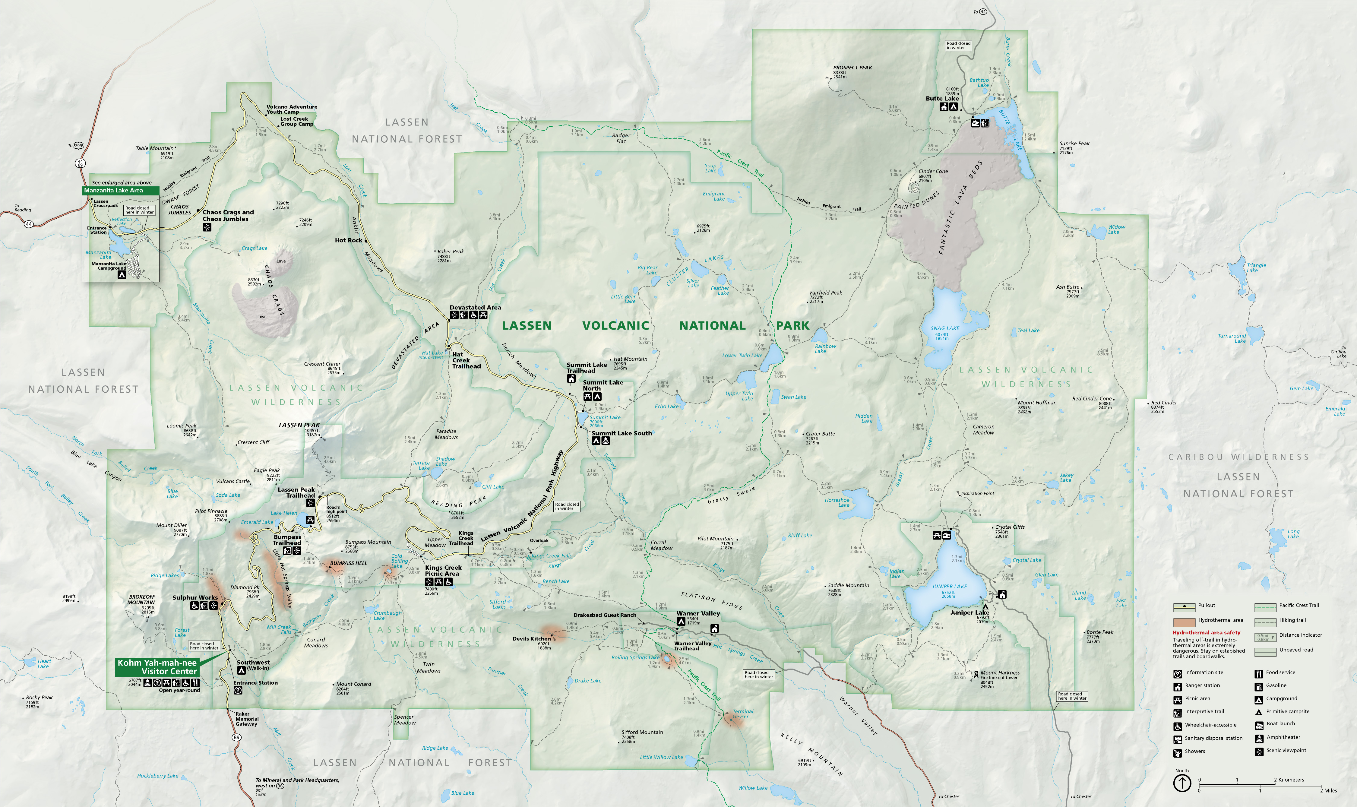
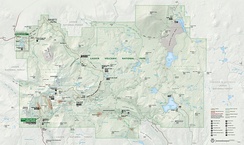
Image: NPS lassen-volcanic-map-2020
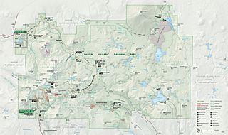
Size of this preview: 800 × 476 pixels. Other resolutions: 320 × 190 pixels | 4,500 × 2,676 pixels.
Original image (4,500 × 2,676 pixels, file size: 2.42 MB, MIME type: image/jpeg)
Description: Official Lassen Volcanic map from the brochure, showing the roads, campgrounds, and trails.
Title: NPS lassen-volcanic-map-2020
Credit: U.S. National Park Service (http://npmaps.com/wp-content/uploads/lassen-volcanic-map.jpg)
Author: U.S. National Park Service, restoration/cleanup by Matt Holly
Usage Terms: Public domain
License: Public domain
Attribution Required?: No
Image usage
The following page links to this image:

All content from Kiddle encyclopedia articles (including the article images and facts) can be freely used under Attribution-ShareAlike license, unless stated otherwise.