
Image: NWT Settlement Locator Tlicho

Size of this PNG preview of this SVG file: 432 × 599 pixels. Other resolution: 173 × 240 pixels.
Original image (SVG file, nominally 922 × 1,278 pixels, file size: 1,006 KB)
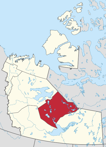
Description: Locator map showing current (c. 2019) Indigenous settlement regions in Northwest Territories, Canada. Boundaries derived from written descriptions where possible. Physical geography derived from NaturalEarth dataset. Projection: custom Transverse Mercator centered on 106W, not supported by EPSG but used internally by the NWT government.
Title: NWT Settlement Locator Tlicho
Credit: Own work
Author: awmcphee
Usage Terms: Creative Commons Zero, Public Domain Dedication
License: CC0
License Link: http://creativecommons.org/publicdomain/zero/1.0/deed.en
Attribution Required?: No
Image usage
The following page links to this image:

All content from Kiddle encyclopedia articles (including the article images and facts) can be freely used under Attribution-ShareAlike license, unless stated otherwise.