
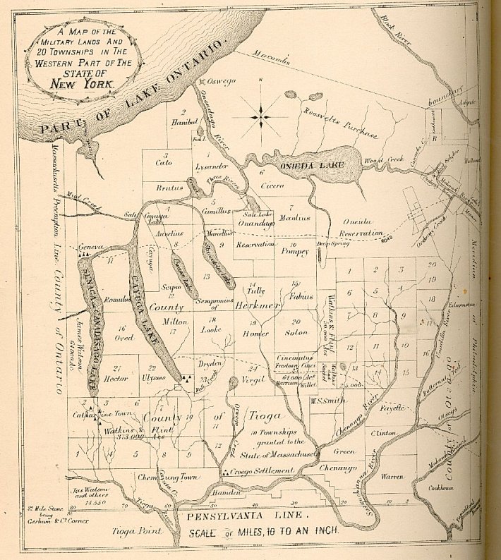
Image: NY-1796map
Size of this preview: 536 × 599 pixels. Other resolutions: 215 × 240 pixels | 710 × 794 pixels.
Original image (710 × 794 pixels, file size: 169 KB, MIME type: image/jpeg)
Description: 1796 map of the Military lands in New York State URL: http://www.rootsweb.com/~srgp/books/1879c04m.htm scanned from History of Tompkins, Schuyler, Chemung, Tioga Counties 1879
Title: NY-1796map
Usage Terms: Public domain
License: Public domain
Attribution Required?: No
Image usage
The following page links to this image:

All content from Kiddle encyclopedia articles (including the article images and facts) can be freely used under Attribution-ShareAlike license, unless stated otherwise.