
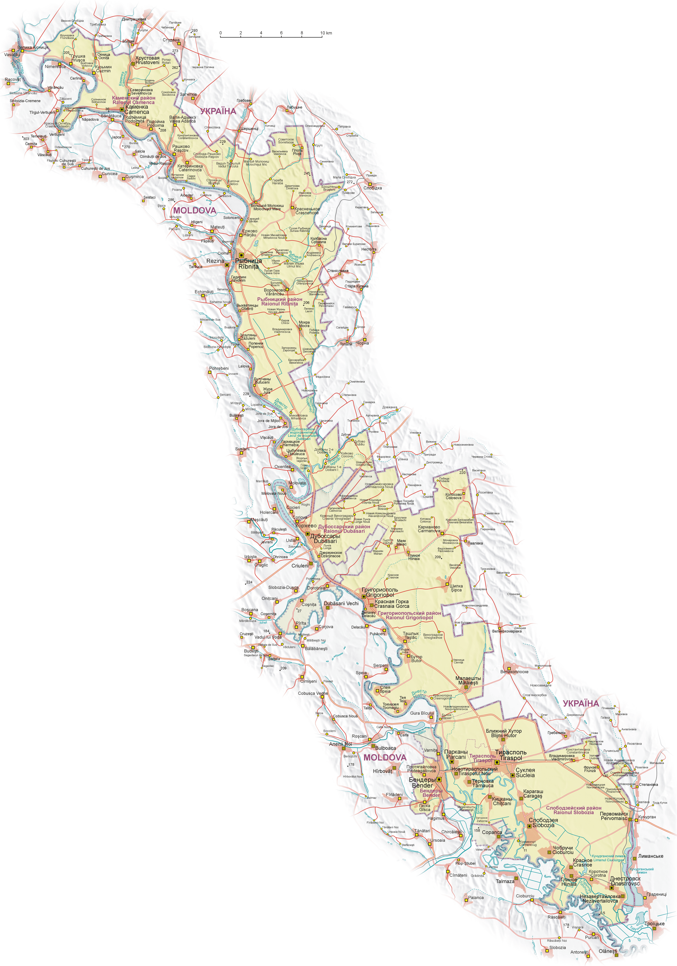
Image: Naddniestrze
Size of this preview: 420 × 599 pixels. Other resolutions: 168 × 240 pixels | 2,655 × 3,786 pixels.
Original image (2,655 × 3,786 pixels, file size: 5.13 MB, MIME type: image/png)
Description: Map of Transnistria (with claimed area), based on Soviet and Ukrainian topographic map, and Shuttle Radar Topography Mission (STRM). Geographical names: in Transnistria: Russian names in cyrillic alphabet according to Transnistrian government and Moldavian names in latin alphabet in Moldova proper: Moldavian names in latin alphabet in Ukraine: Ukrainian names in cyrillic alphabet Legend:
Title: Naddniestrze
Credit: Own work
Author: Aotearoa
Usage Terms: Creative Commons Attribution-Share Alike 3.0
License: CC-BY-SA-3.0
License Link: http://creativecommons.org/licenses/by-sa/3.0/
Attribution Required?: Yes
Image usage
The following page links to this image:

All content from Kiddle encyclopedia articles (including the article images and facts) can be freely used under Attribution-ShareAlike license, unless stated otherwise.