
Image: Nansen Greenland Crossing Map

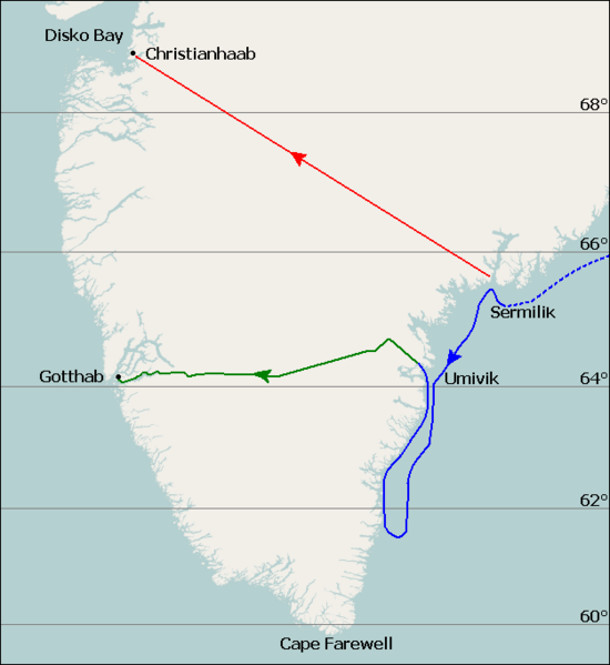
Description: Map of Fridtjof Nansen's 1888 route across Greenland, the first crossing of the island. Dotted line is the ship Jason's journey from Iceland to near Sermilik fjord (now known as Sermiligaaq), continuous blue line is the journey made by Nansen and his companions in two small boats trying to reach the coast. Planned journey from Sermilik northwest to Christianhaab (today known as Qasigiannguit). Nansen's actual journey across Greenland from Umivik fjord to Gothaab (today known as Nuuk).
Title: Nansen Greenland Crossing Map
Credit: Base map is File:Location map Greenland Southern.png, sea (blue) and land (green) journey lines based on File:NansenGreenlandrevisedMap.jpg, published 1888. Latitude lines based on Google Earth sateliite photos.
Author: Base map is from OpenStreetMap by User:Dr. Blofeld, labels, latitude lines, and journey lines added by Ruhrfisch (talk)
Permission: GFDL, CC-BY-SA
Usage Terms: Creative Commons Attribution-Share Alike 4.0
License: CC BY-SA 4.0
License Link: https://creativecommons.org/licenses/by-sa/4.0
Attribution Required?: Yes
Image usage
The following page links to this image:
