
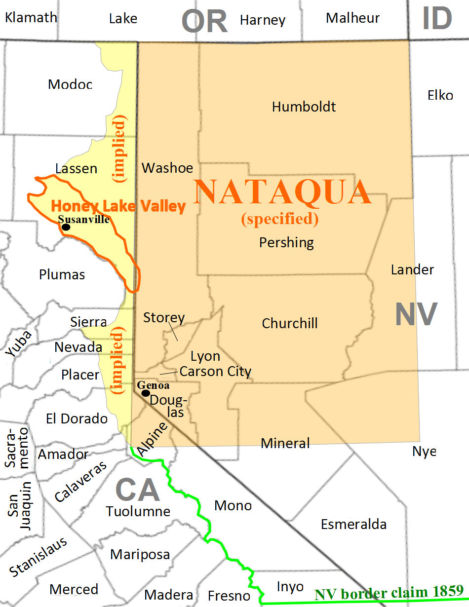
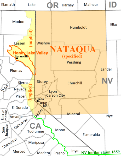
Image: Nataqua Territory map
Size of this preview: 463 × 599 pixels. Other resolutions: 185 × 240 pixels | 950 × 1,230 pixels.
Original image (950 × 1,230 pixels, file size: 133 KB, MIME type: image/png)
Description: Map of Nataqua Territory, a provisional territory in western Nevada, and northeast California 1856-1861.
Title: Nataqua Territory map
Credit: Own work. Based on a description given in Davis, William Newell, Jr. (September 1942). "The Territory of Nataqua: an Episode in Pioneer Government East of the Sierra". California Historical Society Quarterly 1 (3): 225-28..
Author: Diltsgd
Usage Terms: Creative Commons Attribution-Share Alike 3.0
License: CC BY-SA 3.0
License Link: https://creativecommons.org/licenses/by-sa/3.0
Attribution Required?: Yes
Image usage
The following 2 pages link to this image:

All content from Kiddle encyclopedia articles (including the article images and facts) can be freely used under Attribution-ShareAlike license, unless stated otherwise.