
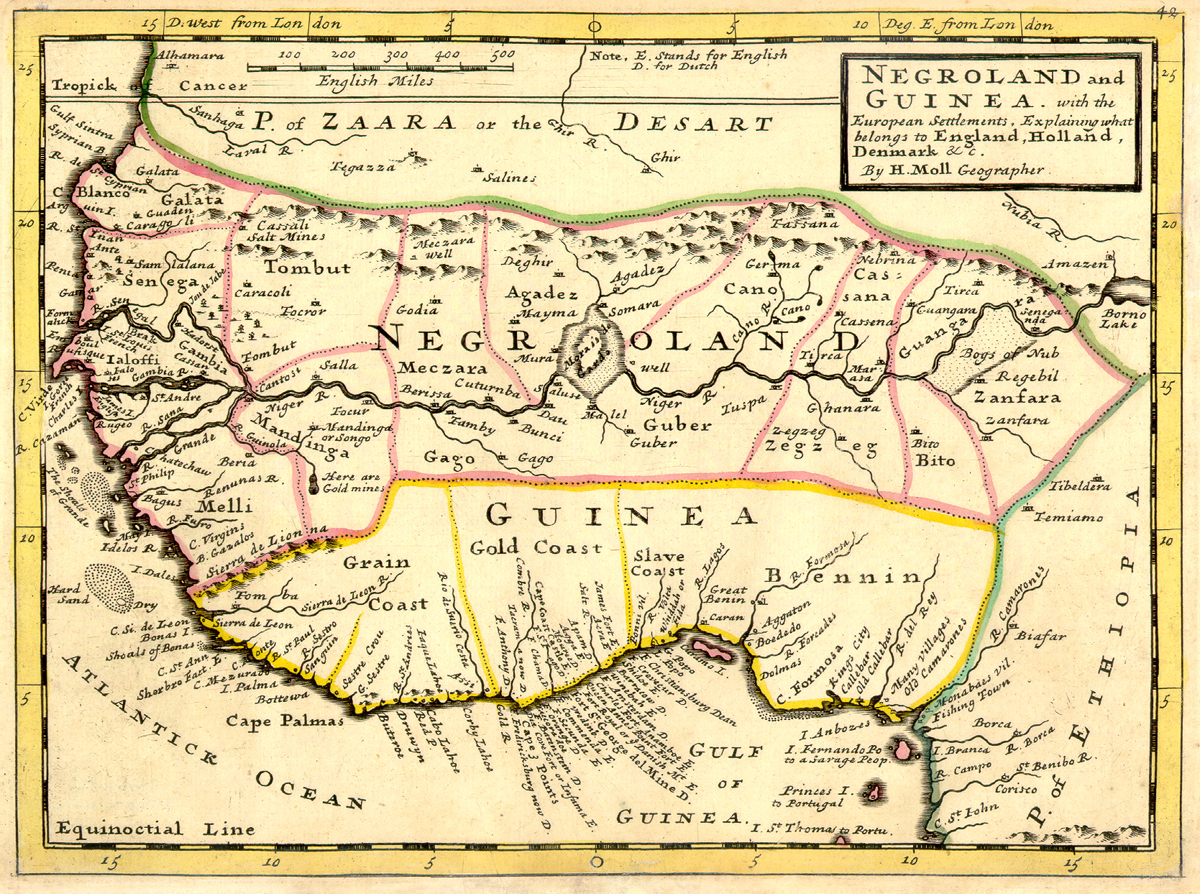
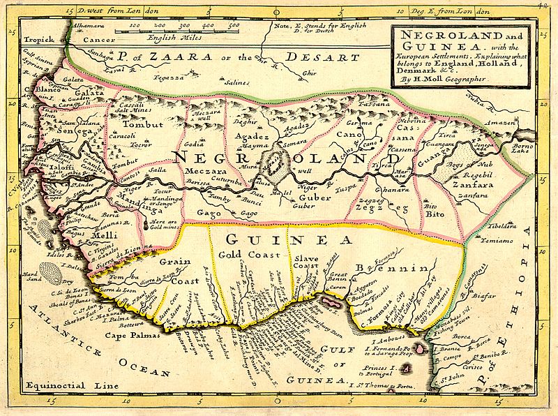
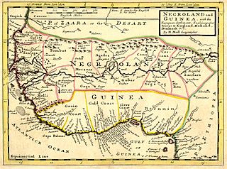
Image: Negroland and Guinea with the European Settlements, 1736
Size of this preview: 800 × 596 pixels. Other resolutions: 320 × 238 pixels | 1,200 × 894 pixels.
Original image (1,200 × 894 pixels, file size: 1.55 MB, MIME type: image/jpeg)
Description: Full title: 'Negroland and Guinea with the European Settlements, Explaining what belongs to England, Holland, Denmark, etc'. By H. Moll Geographer (Printed and sold by T. Bowles next ye Chapter House in St. Pauls Church yard, & I. Bowles at ye Black Horse in Cornhill, 1729, orig. published in 1727). [1]
Title: Negroland and Guinea with the European Settlements, 1736
Credit: University of Florida, George A. Smathers Libraries, historic African maps: 1729 Herman Moll (#ALW1663)
Author: Herman Moll
Usage Terms: Public domain
License: Public domain
Attribution Required?: No
Image usage
The following 6 pages link to this image:

All content from Kiddle encyclopedia articles (including the article images and facts) can be freely used under Attribution-ShareAlike license, unless stated otherwise.