
Image: NewGuineaSelonUsher
Size of this preview: 800 × 265 pixels. Other resolutions: 320 × 106 pixels | 2,633 × 871 pixels.
Original image (2,633 × 871 pixels, file size: 127 KB, MIME type: image/png)
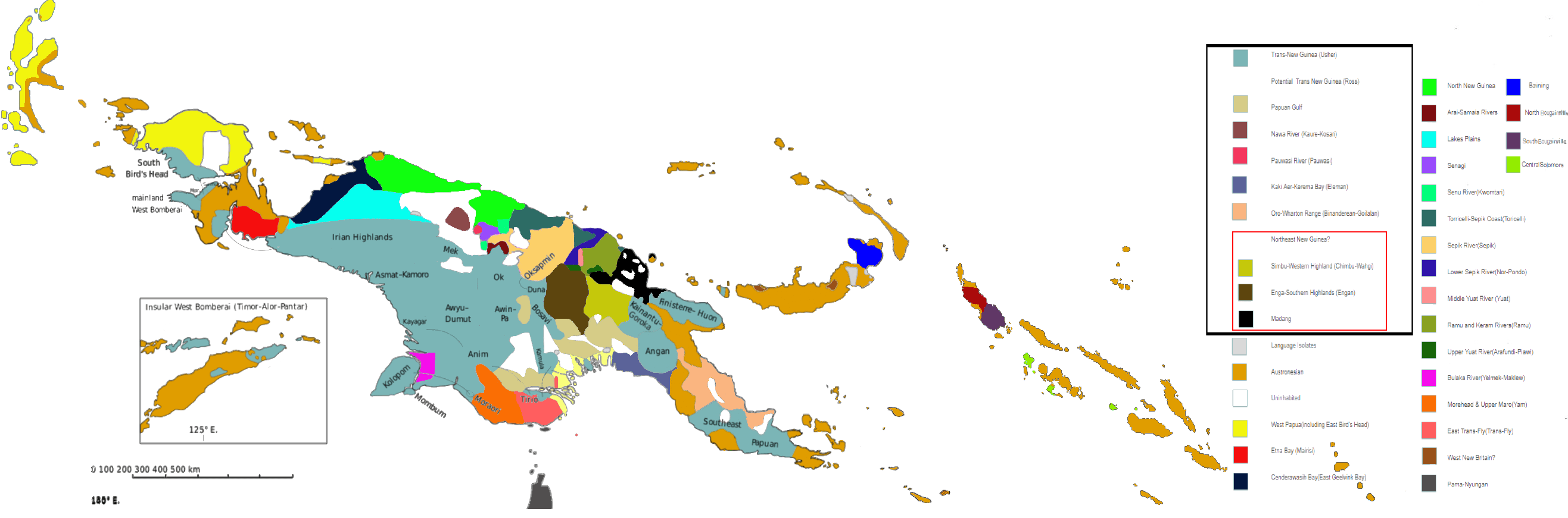
Description: Linguistic map of New Guinea and surrounding islands, including the North Moluccas, Solomon Islands, the Torres Strait Islands and Northern Australia. Classification of the Languages East of New Guinea proper was not taken into consideration by Usher. The Yele Dinye language isolate of Rossel Island is either West New Britain or Austronesian, and is shown as striped with both colours.
Title: NewGuineaSelonUsher
Credit: Own work
Author: MToumbola
Usage Terms: Creative Commons Attribution-Share Alike 4.0
License: CC BY-SA 4.0
License Link: https://creativecommons.org/licenses/by-sa/4.0
Attribution Required?: Yes
Image usage
The following page links to this image:

All content from Kiddle encyclopedia articles (including the article images and facts) can be freely used under Attribution-ShareAlike license, unless stated otherwise.