
Image: NewHavenAreaOutlineMap

Size of this preview: 507 × 600 pixels. Other resolutions: 203 × 240 pixels | 515 × 609 pixels.
Original image (515 × 609 pixels, file size: 9 KB, MIME type: image/png)
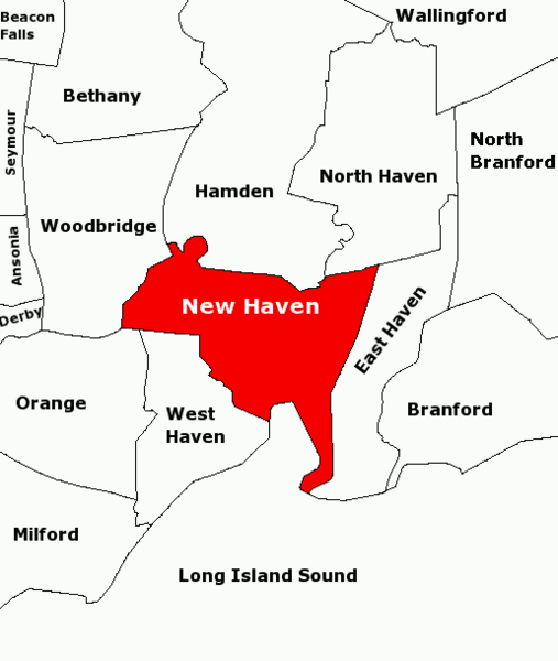
Description: Subject: Map of townships in the New Haven Area. 21-Aug-2007 version fixes town name in upper left: Beacon Falls. Derived from sub-county SVG map of Connecticut at Libre Map Project using Adobe SVG viewer and Gimp 2.2.1.3
Title: NewHavenAreaOutlineMap
Credit: Transferred from en.wikipedia to Commons.
Author: The original uploader was Karlhahn at English Wikipedia
Usage Terms: Creative Commons Attribution 2.0
License: CC BY 2.0
License Link: http://creativecommons.org/licenses/by/2.0
Attribution Required?: Yes
Image usage
The following page links to this image:

All content from Kiddle encyclopedia articles (including the article images and facts) can be freely used under Attribution-ShareAlike license, unless stated otherwise.