
Image: New Geographic Map of the Interior of Malaca WDL972

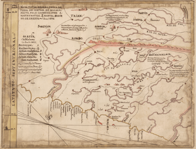
Description: This map showing the Strait of Malacca and the interior of the Malay Peninsula is the work of Malaysian-Portuguese cartographer Emanuel Godinho de Eredia (1563-1623). At the turn of the 17th century, the Portuguese were exploring southeast Asia from their base in Malacca, searching for the “Islands of Gold” that figured prominently in Malaysian legends. Around 1602, the viceroy of Portuguese India commissioned an expedition around the islands south of Malaysia and India. Eredia served as a soldier and engineer on the mission and completed this map around the same time. His work, however, is suspected to be based more on the writings of Ptolemy and Marco Polo than on his own experience.
Title: New Geographic Map of the Interior of Malaca
Credit: http://dl.wdl.org/972.png Gallery: http://www.wdl.org/en/item/972/
Author: Godinho de Eredia, Manuel (1563-1623)
Usage Terms: Public domain
License: Public domain
Attribution Required?: No
Image usage
The following page links to this image:
