
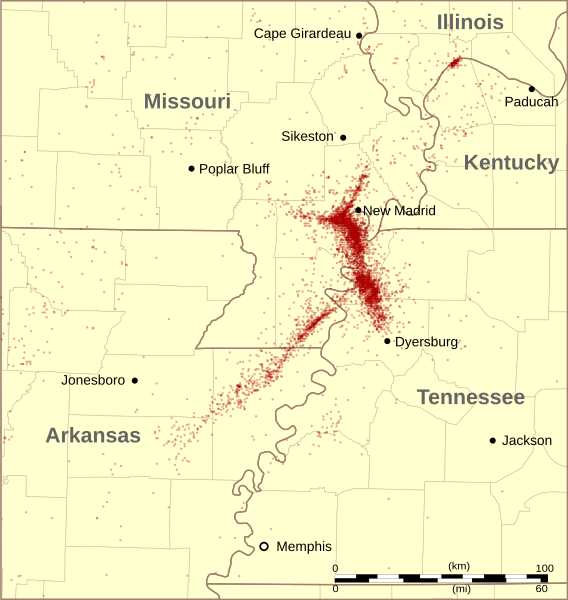
Image: New Madrid Seismic Zone activity 1974-2011

Description: Earthquakes recorded in the New Madrid Seismic Zone — in the Mississippi River Valley. Located primarily through Arkansas, Missouri, and Tennessee in the central United States from June 1974 to July 2011. Without indicication of magnitude. Most of the tremors represented on the map were below the threshold of human sensitivity. There are 6057 tremors on this map, which includes a certain number not on the New Madrid faults. Quake epicenters are depicted with small circles with an opacity of 33%, and the opacity is cumulative when circles overlap. Therefore areas with multiple closely spaced quakes over time will be covered in deeper shades of red. Data from Center for Earthquake Research and Information at University of Memphis.
Title: New Madrid Seismic Zone activity 1974-2011
Credit: Own work
Author: Kbh3rd
Usage Terms: Creative Commons Attribution-Share Alike 3.0
License: CC BY-SA 3.0
License Link: http://creativecommons.org/licenses/by-sa/3.0
Attribution Required?: Yes
Image usage
The following page links to this image:
