
Image: New Madrid and Wabash seizmic zones-USGS mod
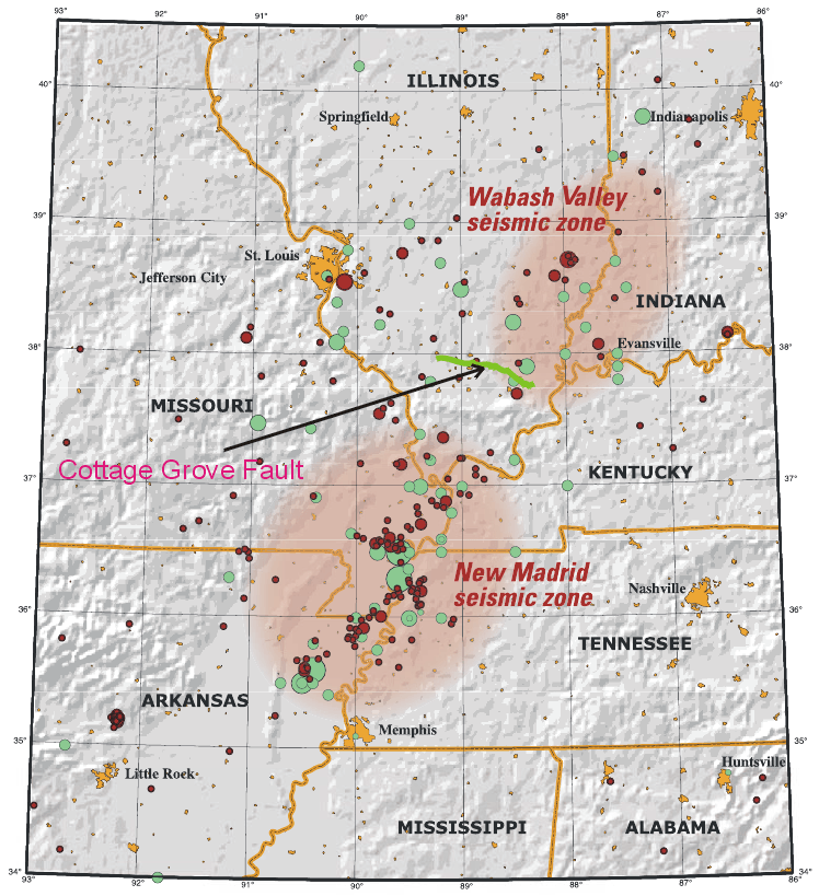
Description: This map of the New Madrid and Wabash Valley seismic zones shows earthquakes as circles. Red circles indicate earthquakes that occurred from 1974 to 2002 with magnitudes larger than 2.5 located using modern instruments (University of Memphis). Green circles denote earthquakes that occurred prior to 1974 (USGS Professional Paper 1527). Larger earthquakes are represented by larger circles. The Cottage Grove Fault is indicated by the green line.
Title: New Madrid and Wabash seizmic zones-USGS mod
Credit: New_Madrid_and_Wabash_seizmic_zones-USGS.png
Author: New_Madrid_and_Wabash_seizmic_zones-USGS.png: Joan Gomberg and Eugene Schweig derivative work: Ruslik (talk)
Usage Terms: Public domain
License: Public domain
Attribution Required?: No
Image usage
The following page links to this image:
