
Image: New Purchase Boundary marker (Delphi, Indiana)
Size of this preview: 800 × 533 pixels. Other resolutions: 320 × 213 pixels | 1,200 × 800 pixels.
Original image (1,200 × 800 pixels, file size: 490 KB, MIME type: image/png)
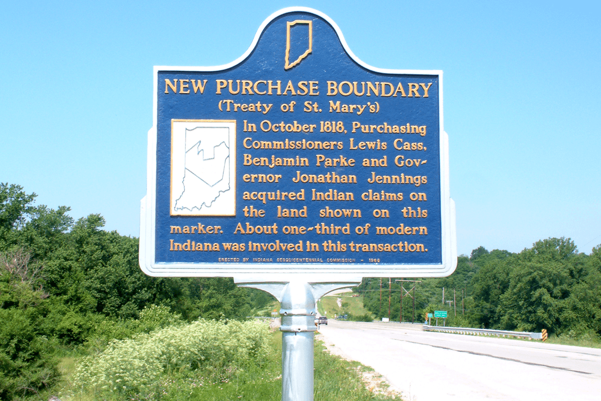
Description: The "New Purchase Boundary" historical marker in Carroll County, Indiana, west of the town of Delphi along U.S. Route 421 (Indiana State Roads 39 and 18) . It reads: New Purchase Boundary (Treaty of St. Mary's) In October 1818, Purchasing Commissioners Lewis Cass, Benjamin Parke and Governor Jonathan Jennings acquired Indian claims on the land shown on this marker. About one-third of modern Indiana was involved in this transaction.
Title: New Purchase Boundary marker (Delphi, Indiana)
Credit: Own work
Author: Huw Williams (Huwmanbeing)
Usage Terms: Public domain
License: Public domain
Attribution Required?: No
Image usage
The following page links to this image:

All content from Kiddle encyclopedia articles (including the article images and facts) can be freely used under Attribution-ShareAlike license, unless stated otherwise.
.png)