
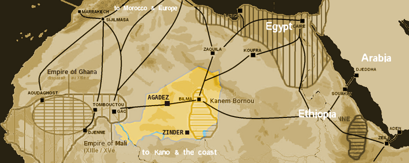
Image: Niger saharan medieval trade routes

Size of this preview: 800 × 319 pixels. Other resolutions: 320 × 128 pixels | 817 × 326 pixels.
Original image (817 × 326 pixels, file size: 263 KB, MIME type: image/png)
Description: Map of Medieval Saharan Trade routes circa 1400 CE, centered on Niger
Title: Niger saharan medieval trade routes
Credit: self-made using The Gimp and Image:Africa historical traite.JPG
Author: T L Miles
Permission: Public Domain
Usage Terms: Public domain
License: Public domain
Attribution Required?: No
Image usage
The following 3 pages link to this image:

All content from Kiddle encyclopedia articles (including the article images and facts) can be freely used under Attribution-ShareAlike license, unless stated otherwise.