
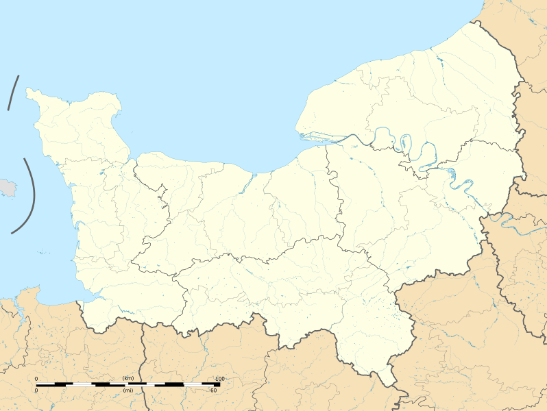
Image: Normandie region location map

Size of this PNG preview of this SVG file: 798 × 600 pixels. Other resolution: 319 × 240 pixels.
Original image (SVG file, nominally 2,094 × 1,574 pixels, file size: 5.25 MB)
Description: Carte administrative vierge de la région Normandie, France, destinée à la géolocalisation.
Title: Normandie region location map
Credit: Own work Sources of data: NASA Shuttle Radar Topography Mission (SRTM3 v.2 & SWBD) (public domain) ; Directive Cadre sur l'Eau; GEOFLA.
Author: Flappiefh
Usage Terms: Creative Commons Attribution-Share Alike 4.0
License: CC BY-SA 4.0
License Link: https://creativecommons.org/licenses/by-sa/4.0
Attribution Required?: Yes
Image usage
More than 100 pages link to this image. The following list shows the first 100 page links to this image only. A full list is available.
- Ablon
- Acqueville, Calvados
- Agy
- Aignerville
- Airan
- Amayé-sur-Orne
- Amayé-sur-Seulles
- Amblie
- Amfreville, Calvados
- Anctoville
- Angerville, Calvados
- Angoville, Calvados
- Anguerny
- Anisy
- Annebault
- Arganchy
- Argences
- Arromanches-les-Bains
- Asnelles
- Asnières-en-Bessin
- Auberville
- Aubigny, Calvados
- Audrieu
- Aunay-sur-Odon
- Auquainville
- Authie, Calvados
- Auvillars
- Avenay
- Balleroy
- Banneville-la-Campagne
- Banneville-sur-Ajon
- Banville
- Barbery, Calvados
- Barbeville
- Barneville-la-Bertran
- Baron-sur-Odon
- Barou-en-Auge
- Basly
- Basseneville
- Bauquay
- Bavent
- Bayeux
- Bazenville
- Beaufour-Druval
- Beaulieu, Calvados
- Beaumais
- Beaumesnil, Calvados
- Beaumont-en-Auge
- Bellengreville, Calvados
- Bellou
- Benerville-sur-Mer
- Bernesq
- Bernières-d'Ailly
- Bernières-le-Patry
- Bernières-sur-Mer
- Beuvillers, Calvados
- Beuvron-en-Auge
- Billy, Calvados
- Bissières
- Biéville-Beuville
- Biéville-Quétiéville
- Blainville-sur-Orne
- Blangy-le-Château
- Blay
- Blonville-sur-Mer
- Boissey, Calvados
- Bonnebosq
- Bonnemaison
- Bonneville-la-Louvet
- Bonneville-sur-Touques
- Bonnœil
- Bons-Tassilly
- Bougy
- Boulon
- Bourgeauville
- Bourguébus
- Branville
- Bretteville-l'Orgueilleuse
- Bretteville-le-Rabet
- Bretteville-sur-Dives
- Bretteville-sur-Laize
- Bretteville-sur-Odon
- Bricqueville
- Brouay
- Brucourt
- Brémoy
- Bréville-les-Monts
- Bucéels
- Burcy, Calvados
- Bures-les-Monts
- Bénouville, Calvados
- Bény-sur-Mer
- Cabourg
- Caen
- Cagny, Calvados
- Cahagnes
- Cahagnolles
- Cairon
- Cambes-en-Plaine
- Cambremer

All content from Kiddle encyclopedia articles (including the article images and facts) can be freely used under Attribution-ShareAlike license, unless stated otherwise.