
Image: NorthAmerica1762-83
No higher resolution available.
NorthAmerica1762-83.png (787 × 600 pixels, file size: 90 KB, MIME type: image/png)
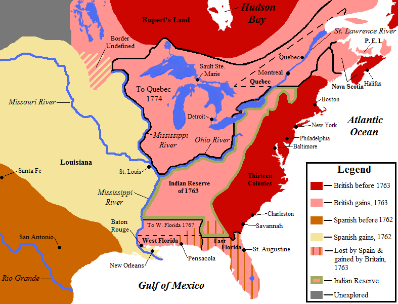
Description: Map showing territorial gains of Britain and Spain following the French and Indian War. Also shown are boundary changes within the territory the British had acquired between 1763 to 1783. Territorial lands held by the British before 1763 is shown in red, land gained by Britain in 1763 is shown in pink. The lands ceded to the Kingdom of Spain in secret during 1762 are in light yellow.
Title: NorthAmerica1762-83
Credit: Own work by uploader, base map used is found here, uploaded by User:Roke
Author: Jon Platek
Usage Terms: Creative Commons Attribution-Share Alike 3.0
License: CC BY-SA 3.0
License Link: http://creativecommons.org/licenses/by-sa/3.0
Attribution Required?: Yes
Image usage
The following 16 pages link to this image:
- American Revolution
- American Revolutionary War
- Historic regions of the United States
- Historical regions of the United States
- History of Canada
- History of Canada (1763–1867)
- History of Oklahoma
- History of Virginia
- Main Line of Public Works
- Monarchy of Canada and the Indigenous peoples of Canada
- New France
- Royal Proclamation of 1763
- Seven Years' War
- Thirteen Colonies
- Treaty of Paris (1763)
- William Pitt, 1st Earl of Chatham

All content from Kiddle encyclopedia articles (including the article images and facts) can be freely used under Attribution-ShareAlike license, unless stated otherwise.