
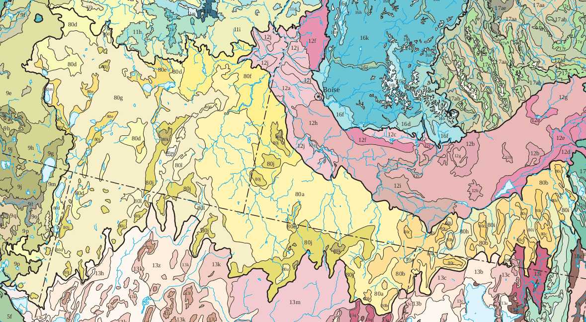
Image: Northern Basin and Range ecoregion map
Size of this preview: 800 × 439 pixels. Other resolutions: 320 × 176 pixels | 1,179 × 647 pixels.
Original image (1,179 × 647 pixels, file size: 211 KB, MIME type: image/gif)
Description: Map of North Basin and Range ecoregion (Ecoregion 80 as defined the by US EPA)
Title: Northern Basin and Range ecoregion map
Credit: https://gaftp.epa.gov/EPADataCommons/ORD/Ecoregions/us/Eco_Level_IV_US.pdf
Author: U.S. Environmental Protection Agency
Permission: This image (or other media) is a work of an Environmental Protection Agency employee, taken or made as part of that person's official duties. As works of the U.S. federal government, all EPA images are in the public domain.
Usage Terms: Public domain
License: Public domain
Attribution Required?: No
Image usage
The following page links to this image:

All content from Kiddle encyclopedia articles (including the article images and facts) can be freely used under Attribution-ShareAlike license, unless stated otherwise.